The concepts proffered in paper generally are in relation to developed jurisdictions that have fully embraced the Information Age and its significant investments in digital data management. Since 2001, and as a means of improving the administration of marine and coastal spaces through decision support, interested members of the international geomatics community have increased research efforts towards the development of marine cadastres in various jurisdictions. Among them are researchers from Canada, Australia and the United States of America (USA) (Collier, Leahy and Williamson, 2001; Ng’ang’a, Sutherland and Nichols, 2002; Sutherland, Wilkins, and Nichols, 2002; Barry, Elema and van der Molen, 2003; Binns et al., 2003; Ng’ang’a et al., 2004; Sutherland, 2004; Sutherland and Nichols, 2004; FGDC, 2008). The main focus of this paper is Canada but developments from the U.S. and Australia are briefly discussed.

Land administration and ict Over the past thirty years, considerable progress has been made since the initial work on first registration programs using largely analogue, methods of data capture, presentation and records management. The early adoption of total stations and electronic data recording by land surveyors, post processing using computer-aided drafting (CAD) and GIS, as well as data storage in relational database management systems have been highly successful.

Since taking over the position of president of the International Association of Geodesy (IAG – http:// www.iag-aig.org) on the 6th July 2011, I have had on occasion mused on what geodesy “is” and how to explain this arcane field to those who are not acquainted with it. For example, how do I tell the Dean of the Faculty of Engineering, at the University of New South Wales, Sydney (Australia), that I, the head of a department within his faculty which has its primary objective the education of undergraduate students in “surveying” (or more broadly in “geomatics”), now occupy an important position in the geoscience field of “Geodesy and Geophysics”? (This is not an idle exercise, as the Dean will be asked to approve my increased travel commitments over the next four years

LightSquared is a gem! I am not only talking about its nationwide high-speed 4G capabilities and that it will be a boost to our lagging IT industry which has fallen behind 18 other nations. I am focusing on how it can beautifully complement high precision applications of GPS. It is a gem for GPS high precision users and for RTK.

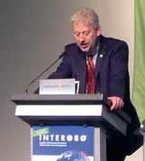
After the three-day INTERGEO event in Nuremberg, one thing was clear: “INTERGEO is a platform for dialogue between technology users from a variety of sectors – dialogue that gives rise to new approaches and applications. The resultant scope of possible new uses is considerable,” stated Olaf Freier, Managing Director of HINTE GmbH and INTERGEO organiser. “There is quite simply no better specialist platform for suppliers and users to network than this leading international trade fair,” said Professor Karl-Friedrich Thöne, President of INTERGEO patron DVW e.V. – the German Society for Geodesy, Geoinformation and Land Management.

USTDA helps countries expand economic growth by utilizing U.S. expertise, technology, and investment. The Agency’s objectives are to help build the infrastructure for trade, match U.S. technological expertise with overseas development needs, and help create lasting business partnerships between the United States and emerging market economies.

Hemisphere GPS is focused on building rugged GNSS products for a variety of industries including surveying, marine and original equipment manufacturing (OEM). In the surveying industry, we manufacture a wide range of products from high-accuracy GNSS receivers to geodetic grade antennas. In addition, we offer an exclusive line of Vector GNSS Compass products for professionals heading and positioning. Our customers use these unique all-in-one compasses for everything from hydrographic surveying to yachting and dredging to autonomous machine control. On the OEM side of our business, we supply system integrators with our proprietary Hemisphere GPS technology for them to integrate into their own finished products. In fact, nearly every Hemisphere GPS finished product is broken down to its core board level and offered to original equipment manufactures for integration into their custom applications.
November 2011:
ENC 2011, 29 Nov – 1 Dec, London, UK, www.enc2011.org;
ELMF 2011, 29 Nov – 30 November, Salzburg, Austria, www.lidarmap.org/ELMF/
Juniper Systems has partnered with Topcon Positioning Systems (TPS) and will manufacture the Topcon Tesla™, the newest data collector in Topcon’s full lineup of rugged handheld computers and solutions for the survey industry. The Tesla features the advantages of both a rugged handheld and a tablet PC, without the disadvantages of either.


 (5.00 out of 5)