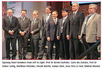
The new Bureau to lead the United Nations Committee of Experts on Global Geospatial Information Management (UN-GGIM) has been elected by the Member States.
Emergent coastal structures such as groins, detached offshore breakwaters, and sea walls have been successfully adopted as coastal protection measures for many decades (Dean and Dalrymple, 2001: Silvester and Hsu, 1997). These type of structures are common in the US and Europe (Dean and Dalrymple, 2001), and even more so in Japan, where Seiji et al.
European Geostationary Navigation Overlay Service (EGNOS), the European Satellite Based Augmentation System (SBAS), provides corrections and integrity information to GPS signals over a broad area centred over Europe, and is fully interoperable with other existing SBAS systems (e.g., WAAS, the brand name of the American SBAS).
In 2014, the INSPIRE Directive had its seventh birthday and is undergoing revision. During those seven years the Directive and its regulation were implemented into the national law of the EU states. Additions were made as well as numerous technical guidelines (TG) and other documents, which were designed to better explain individual requirements and assist in their implementation. These documents have recommendatory character.
When looking at the timeline of technology of today’s consumer electronics, there are several interesting connections with technology and associated infrastructure originally (at least partly) developed in the cont ext of DoD funded projects. Large-scale integration of this technology into consumer electronics created an economy of scale that is unmatched, enabling capabilities and services that otherwise may have been prohibitive due to cost.
Vol. X, Issue 8, August 2014
Zip
Performance measurement of EGNOS Integrity and Continuity
H P J Veerman, A J P Van Kleef, J D Van Bruggenvan Putten
Choosing Suitable Map Projections for Worldwide Depiction of Electronic Charts in ECDIS
Athanasios Pallikaris
On high quality Courseware-Making strategies
Erhu WEI, Zhixiang YIN
KOPOS – Kosovo Positioning System
Prof Dr …
AT A GLANCE
► SSTL wins Best Aerospaceand Defence company at theMade in the UK Awards
► 1Spatial Awarded MajorUK Ministry Of DefenceAeronautical Contract
► SuperGIS Training Centrein Geomatika UniversityCollege, Malaysia
► Stonewall Surveying raises$1820 for Barrington charities
► Hexagon Geospatial Partnerswith Geoimage in Australia
► GPS Insight Receives 2014 M2MEvolution Asset Tracking Award
► Bentley’s enhanced AssetWiseAPM V7.2 released
► NGA awards …