

The authors have continued a research on the prediction of earthquake using GPS data in Japan, one of the disaster prone countries since 2000. The authors have discovered pre-signals of those past big earthquakes with more than M6, such as Miyagi Offshore and Hokubu Earthquakes (2003.5.26; M7.1 and 7.26; M6.4), Tokachi Offshore Earthquake (2003.9.26; M8.0)…
GLONASS for civilian use in 2006
The restrictions on precise satellite definition of on-land coordinates will be lifted by yearend, a senior military official said. Lieutenant-General Valery Filatov said the location of geographical objects at accuracy of up to 30 meters would be available for civilian use from the Russian GLONASS satellite system and the US GPS.
www.spacedaily.com
New Tiny Surface Mount GPS Receiver
Trimble has introduced its new Copernicus GPS receiver – a thumbnail-sized, surface-mount, low power module ideal for adding GPS capabilities to Bluetooth appliances, sport accessories, personal navigators or cameras, computer and communication peripherals as well as vehicle tracking, navigation, and security products.
It enables system integrators to easily add GPS capability to a mobile device with minimal impact on its size or battery life at a very economical price.
www.trimble.com
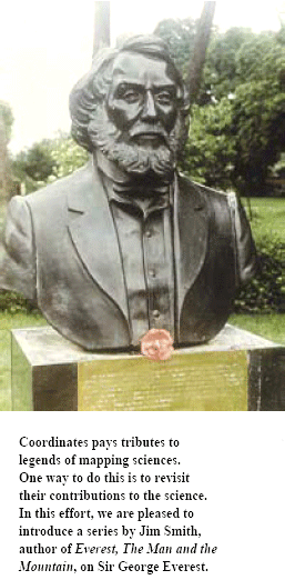
Beginning with this issue, JR Smith traces the life and work of Sir George Everest
My interest in Everest came about in two ways. Firstly in the early 1980s I had the idea of compiling a history of land surveying. It was soon obvious that it was a far too wide a topic to do justice …

says Dr Vanessa Lawrence, Director General and Chief …
GIOVE A Transmits Loud And Clear
After launch and platform commissioning, GIOVE A started signal transmission on 12 January and the quality of these signals is now being checked. This checking process is employing several facilities, including the Navigation Laboratory at ESA’s European Space Research and Technology Centre (ESTEC), in the Netherlands, the ESA ground station at Redu, in Belgium, and the Rutherford Appleton Laboratory (RAL) Chilbolton Observatory in the United Kingdom.
Chilbolton’s 25 metre antenna makes it possible to acquire the signals from GIOVE A and verify they conform to the Galileo system’s design specifi cation. Each time the satellite is visible from Chilbolton, the large antenna is activated and tracks the satellite. GIOVE A orbits at an altitude of 23 260 kilometres, making a complete journey around the Earth in 14 hours and 22 minutes.
The GIOVE A mission also represents an opportunity for the testing of a key element of the future Galileo system, the user receivers. The first Galileo experimental receivers, manufactured by Septentrio of Belgium, were installed at the Redu and Chilbolton In Orbit Test Stations and at the Guildford, United Kingdom, premises of Surrey Satellite Technology Limited (SSTL), the manufacturer of the satellite and now in charge of its control in orbit.
PCI Geomatics supports CARTOSAT-1 satellite data
PCI Geomatics announced that it has entered into a memorandum of understanding with Antrix Corporation Ltd. to develop an interface that integrates CARTOSAT-1 satellite data products in Geomatica, PCI Geomatics image-centric geospatial software. Antrix, a corporate arm of the Indian Space Research Organization (ISRO), launched the CARTOSAT-1 satellite on May 5, 2005, to provide stereo data for advanced and large scale mapping applications.
www.pcigeomatics.com
Multimap Australasia announces online mapping deal Multimap, one of the online mapping providers, announced the implementation of its online mapping services for the Commonwealth Travel Services Corporation (CTC), at the Travel Distribution Summit in Singapore (14th & 15th February, 2006). Now, customers of one of the largest and most trusted travel and tour operators in Singapore can access content-rich, easy-to-read interactive maps of their…

The GPS technology is being used extensively all over the world to generate useful data for different purposes. The Department of Science
and Technology, Government of India has evolved a programme on GPS to study crustal deformation processes with the following objectives…

Traditionally GIS are considered to perform four basic functions on spatial data; input, storage, analysis and output. Of these, analysis has received least attention in commercial systems. Typically, a variety of map description and manipulation functions are defi ned by commercial vendors as being “Spatial analysis”, but they have little bearing on the use of this term in the Regional Science Community…


 (5.00 out of 5)