Articles in the Articles Category


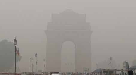
In 2017, 77% population of India was exposed to ambient PM2.5 above 40 μg/m3, which is the recommended limit by the National Ambient Air Quality…

On emerging wide-area high-accuracy open PPP/PPP-RTK correction service and low-cost multi-frequency GNSS receivers, the centimeter-level high-accuracy positioning…
Gasp Chamber
With air quality at dangerous level
This time around air pollution in Delhi
Led to health emergency.
Several desperate measures were taken,
Banned on construction activities,=
Plying of vehicles with odd-even numbers on odd and even dates
Schools closed for few days,
Alas! not with desired results. …
October 2019
Commercial UAV Expo Americas
28 – 30 October
Las Vegas, USA
www.expouav.com
Commercial UAV Expo
28 – 30 October Las Vegas, USA
www.expouav.com
ISGNSS 2019
29 October – 1 November Jeju Island, South Korea
www.ipnt.or.kr/isgnss2019
November 2019
International Timing and Sync Forum 2019
4-7 November
Brighton, United Kingdom
http://itsf2019.executiveindustryevents.com
GEO Week 2019 and the GEO Ministerial Summit
4-9 November Canberra, Australia
www.earthobservations.org
The Commercial …
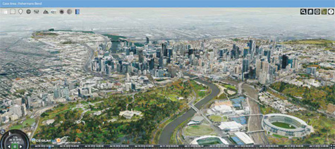
The Centre for Spatial Data Infrastructures and Land Administration (CSDILA) at the University of Melbourne, Australia, has been chosen…

Recent enhancements in satellite remote sensing has increased the value of remotely sensed data for marine ecologist…

“Two important characteristics of maps should be noticed. A map is not the territory it represents, but, if correct, it has a similar…
September 2019
ISDE 11
24 – 27 September
Florence, Italy
digitalearth2019.eu
October 2019
The 8th FIG Land Administration Domain Model Workshop (LADM 2019)
4th International Conferenceon Smart Data and Smart Cities (SDSC2019)
Geomatics Geospatial Technology (GGT2019)
1 – 3 October Kuala Lumpur, Malaysia,
http://isoladm.org http://www.geoinfo.utm
40th Asian Conference on Remote Sensing (ACRS)
13 – 18 October Deajuong City, Korea
www.acrs2019.org
Commercial UAV Expo Americas
28 – 30 October
…

Professor David Last
Consultant Engineer and Expert Witness specialising in Radio Navigati on and Communicati ons Systems. He is a Professor Emeritus at the University of Bangor, Wales and Past-President of the Royal Insti tute of Navigati on
In July this year, Galileo suff ered a week-long outage? How do you regard this ‘technical incident’?
Outages can happen. …

Chris Rizos
Chris Rizos is an Emeritus Professor in the School of Civil and Environmental Engineering and a co-director of the Satellite Navigation and Positioning (SNAP) Lab at UNSW. Chris is president-elect of the International Union of Geodesy & Geophysics (IUGG).
Professor Rizos’ early fascination with old maps and Australia’s exploring pioneers sparked his own exploration of …


 (5.00 out of 5)