Articles in the Articles Category

Septemeber 2008
Institute of Navigation’s Satellite
Division ION GNS 2008
September 16-19, 2008
Savannah, Georgia, USA
http://www.ion.org
The Perspectives, The role of Surveyors in the European Economy and Society
17-19, September
Strasbourg, France
http://www.geometre-strasbourg2008.eu
CARIS 2008
September 22 – …

The study areas are situated in the Arabian Gulf. -It is a shallow sea with its long axis oriented in NW-SE direction, and its average water depth is about 36m. The Evaporation and wind are the main driving forces for water circulation in the Arabian Gulf. Evaporation is stronger in winter due to high wind speed, than summer when the water surface temperature is higher. The overall circulation in the inner Arabian Gulf is cyclonic…

The patented TIDGET® (“tracking widget”) sensor operates by taking brief snapshots of GPS data when activated [1]. These snapshots are stored in the flash memory and forwarded to the LocatorNet Server through the data link for processing [2]. The TIDGET is built using the RF front-end of a commercial GPS chip (see Figure 2). The device is designed to operate with a variety of different types of data links providing a low-power location solution…

The LBS market has been segmented into 3 main categories: • B2C: Business to Consumer • B2B2C: Business to Business to Consumer • B2B: Business to Business Details of this segmentation are provided in Figure 2. This segmentation highlights the diversity of services that can be offered by an operator. This diversity of services is also a diversity of business model. The LBS market has been especially Figure 1…

For reasons unknown, the “GIS/Geographic” has quietly crossed its rightful “domain
It was up to 1985 that everything …

The Ministry of Science & Technology, Government of India and Bentley Systems, Incorporated has launched the 2008-2009 Future Cities India 2020 competition finals. Currently in its third year, the competition encourages students to help prepare India’s cities for the year 2020 by providing design solutions to real-world infrastructure challenges. This …

ESRI’s International User Conference draws more than 14,500 attendees
ESRI President Jack Dangermond
In his opening remarks at ESRI’s 28th …
19-20 August 2008 – Kuala Lumpur, Malaysia
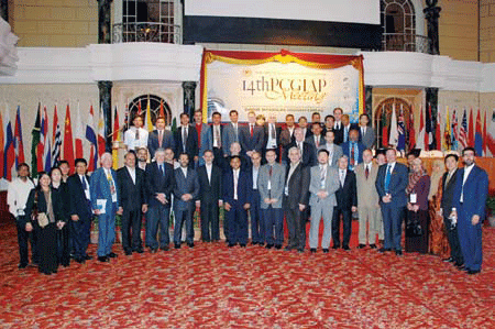
TThe UN sponsored Permanent Committee on GIS Infrastructure
(PCGIAP) together with …
From the role of land administration in sustainable development…
To the promotion of effective land markets.
e-land administration, land registration, cadastral surveying and mapping.
Poverty reduction and protection of vulnerable groups.
A range of issues.
The 14th PCIGIAP meet at Kuala Lumpur discussed and deliberated all.
Another step in a long journey…
The journey which is difficult and tortuous.
Understandably, when one deals …

Mobile tools for wayfinding combined with Location Based Services (LBS) can provide pedestrians with practical information concerning optimal routes and useful facilities in their vicinity. However, what is considered as “optimal” and “useful” largely varies between different kinds of individuals. Inappropriate information may hinder effective information extraction for a person seeking specific navigational and environmental information…


 (5.00 out of 5)