


The Ministry of Housing and Urban Affairs (MoHUA) is engaged in the development and promotion of State-of- Art Technologies…

Although awareness of SLAM (Simultaneous Localization And Mapping) technology is at a very nascent state in some countries such as India…

As Coordinates readers, you appreciate the value of knowing where you are and what time it is, along with the best route to your destination…

Remote sensing relies on hardware, software and workflow processes to deliver consistent and useful imaging products for a broad range of applications…

Volume XVI, Issue 1, January 2020
Zip
The Challenges for Resilient PNT in 2020
Guy Buesnel
The consequences of vulnerabilities within autonomous navigation are alarming
Jennifer Edis
Do we need GNSS alternatives, OR, should we protect what we already have?
Graeme Hooper
The case for automotive GNSS cyber security measures
Yoav Zangvil
Global experiences with public private partnerships for land registry services: A critical review
Keith …
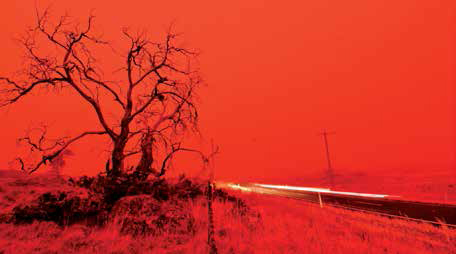
The sky is red
As the summer sets in Australia,
The country especially New South Wales,
Is engulfed with bushfires.
Some reports suggest
27 death so far and many lost their homes,
Millions of hectares of land burned,
Half a billion animal affected,
Potentially millions of them died,
One third of koalas killed,
Even some species …
March 2020
Munich Satellite Navigation Summit
16 – 18 March Munich, Germany
www.munich-satellitenavigation-summit.org
10th International Conference and Exhibition on Geospatial & Remote Sensing (IGRSM 2020)
17 -18 March
Kuala Lumpur, Malaysia
http://igrsm.org/igrsm2020
Geo Connect Asia 2020
18 – 19 March Singapore
http://www.geoconnectasia.com
Geo Week
March 23-25, Washington, DC
www.geoweek.com, www.lidarmap.org
April 2020
United Nations/Mongolia Workshop
on the Applications of GNSS
13 – 17 April
Ulaanbaatar, Mongolia
www.www.unoosa.org
SpaceTimeAI 2020
20 – 22 April London, UK
www.ucl.ac.uk/civil-environmentalgeomatic-engineering/
May 2020
China …
MicroSurvey inCAD 2020 released
MicroSurvey announces the release of inCAD 2020. It adds the MicroSurvey feature set to the latest Autodesk® software – including AutoCAD® 2020, AutoCAD Map 3D™ 2020, and AutoCAD Civil 3D™ 2020 – providing users with complete survey drafting and calculation workflows, including COGO, point tools for gridline-based projects, traverse input and …
White Paper promotes European GNSS for safe, reliable UAVs
The European GNSS Agency has published an online White Paper on European Global Navigation Satellite Systems, asserting that use of Galileo and its corrections via the European Navigation Overlay Service (EGNOS) are essential for the safe and reliable navigation of drones.
The report further states that …


 (5.00 out of 5)