

Volume XVII, Issue 8, August 2021
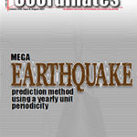
MEGA earthquake prediction method using a yearly unit periodicity
Guangmeng Guo and Shunji Murai
Deeds and titles in harmony: Trinidad and Tobago property business registration system
Mark A Griffin, Carol Roffer, Karen Bridgewater, Nicole Moonan and Aurélie Milledrogues
Humorous science: An introduction
Volker Janssen
Draft Indian Satellite Navigation Policy – 2021
My Coordinates
EDITORIAL
News
INDUSTRY | GNSS | GIS …
September 2021
Commercial UAV Expo Americas
7-9, September Las Vegas USA
www.expouav.com
ION GNSS+ 2021
20-224 September St. Louis, Missouri, USA
www.ion.org/gnss/index.cfm
INTERGEO 2021 Live+Digital
21 – 23 September Hannover, Germany
https://www.intergeo.de
Mapping The Future Of Land Administration & CSDILA’s 20 Years Celebration Event
20-23 September, 2021 Melbourne, Australia
https://www.csdila20-fig.org
November 2021
Digital Construction Week
24-25, November London, UK
www.digitalconstructionweek.com
Navigation 2021
15-18 November
https://rin.org.uk
GEO Business
24-25 November London, UK
www.geobusinessshow.com
Tweet
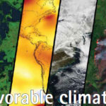
In this year itself, there have been many worrying events of extreme weathers.
In Greenland, for the first time rain fell at the highest point of its ice sheet.
If there are extreme level of flooding in Germany, China and Australia,
Then the Western US is facing one of the worst droughts.
Unprecedented heat waves …
UAV LiDAR to inform carbon emission reduction policy making
A specialist team at the University of Wiconscin-Madison (UW-Madison) used the Routescene UAV LiDAR system to detect and visualize forests in Northern Wisconsin, USA as part of the CHEESEHEAD project. The objective of this wider project is to improve weather forecasting by understanding further how vegetation and …
Ultra-wideband micro-location technology gains traction
From AR games to automatic car locks, pinpointing the location of devices is becoming increasingly important in modern life. The difference being that the precision we demand is far beyond the reach of GPS or Bluetooth. With Ultra-Wideband (UWB) microlocation technology from imec, the location of objects in a space can …
Oceaneering and DDK Positioning sign service agreement
Oceaneering International, Inc., and DDK Positioning Limited have entered into an agreement for the provision of GNSS (Global Navigation Satellite System) augmentation service and all associated software and hardware supporting Oceaneering’s C-Nav Positioning Solutions group offerings.
DDK Positioning’s services are delivered exclusively through the Iridium satellite communications network coupled with …
Exploring the limits of spectral remote sensing imaging systems
The National Geospatial-Intelligence Agency, USA is funding a team of Rochester Institute of Technology imaging scientists to study the limits of spectral remote sensing imaging systems. Led by principal investigator John Kerekes, a professor in the Chester F. Carlson Center for Imaging Science, the team received a …
Galileo Second Generation proof-of-concept testing begins
The first Galileo Second Generation hardware has begun testing, with test versions of the satellites’ navigation payloads undergoing evaluation by Airbus Defence and Space at their Ottobrunn facility in Germany and by Thales Alenia Space at ESA’s ESTEC technical centre in the Netherlands.
These testbed versions of these new navigation payloads …
West Bengal, India begins GIS survey for MSMEs
The state of West Bengal in India, which has the second most number of MSMEs (Micro, Small and Medium Enterprises) in the country, has initiated a GIS survey of the existing 570 MSME clusters, viewing them as a key component of the state’s economy.
The outcome of the survey …


 (5.00 out of 5)