Study on GNSS authentication and security improvements
The E-GIANTS (European GNSS Improved Authentication Solutions) project was commissioned by the European Commission and technically supervised by EUSPA. The project responds to the growing threat posed by quantum computing to traditional cryptographic methods, which could compromise the security of GNSS services in the coming decade. The study highlights …

NASA-ISRO satellite sends first radar images of earth’s surface
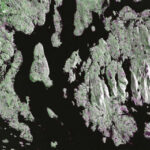
The NISAR (NASA-ISRO Synthetic Aperture Radar) Earth-observing radar satellite’s first images of our planet’s surface are in, and they offer a glimpse of things to come as the joint mission between NASA and ISRO (Indian Space Research Organisation) approaches full science operations later this year. Images from …

Japan model inspires India’s spatial policy for urban planning
The new National Spatial Policy envisions 20-year urban blueprints, regional planning blocks, and transit-led growth to curb haphazard expansion and boost liveability across Indian cities. The three tiers will have proper policy frameworks. Taking a leaf out of …

The analysis performed in this report is solely his work and own opinion. State Program: U.S.A (G); EU (E); China (C) “Only MEO- SECM satellites”; Russia (R); Japan (J); India (I)
Narayan Dhital
Actively involved to support international collaboration in GNSS related activities. He has regularly supported and contributed to different workshops of the International Committee on …

We present a detailed landslide vulnerability map developed on the Google Earth Engine (GEE) platform using a Weighted Overlay Model.
Dr. Satish Kumar Negi
Associate Professor, Department of Geography, Govt. Degree College Dharampur, Solan, Himachal Pradesh, India
Shashi Shekha
Scientific Officer, H.P. State Pollution Control Board, Shimla, Himachal Pradesh, India
Abstract
This study addresses the escalating threat of landslides in Himachal …

This paper presents some background on airborne gravimetry, introduces the NSW Gravity Model and outlines the benefits it will provide to the surveying profession and wider community.
Dr Volker Janssen
Geodetic Surveyor in the Geodesy & State Adjustment team at DCS Spatial Services, NSW Department of Customer Service, in Bathurst, Australia.
Thomas Grinter
Surveyor-General and Director of Survey at …

Volume 21, Issue 9, September 2025
Jahan Jhuggi Wahan- Makaan: In-situ Slum Rehabilitation
A K Jain
GNSS Constellation Specific Monthly Analysis Summary: August 2025
Narayan Dhittal
Empirical orthogonal function based modelling of ionosphere using Turkish GNSS network
Kutubuddin Ansari, Janusz Walo, Selcuk Sagir and Kinga Wezka
My Coordinates
EDITORIAL
News
UAV | GIS | GNSS | IMAGING | INDUSTRY
CALENDAR
October 2025 – November 2025
Advertisers …
October 2025
Intergeo 2025
7-9 October
Frankfurt, Germany
https://dvw.de/intergeo/en
The 8th ISPRS Geospatial Conference
13-15 October 2025
Tehran, Iran
https://geospatialconf2025.ut.ac.ir
The Arab Conference on Astronomy and Geophysics
13 – 16 October 2025
Cairo, Egypt
https://acag-conf.org
AOGEO Symposium
15 – 17 October 2025
Bangkok, Thailand
https://aogeo17.gistda.or.th
The 46th Asian Conference on Remote Sensing
27 – 31 October 2025
Makassar, Indonesia.
https://acrs2025.mapin.or.id
3rd MENA Geospatial Forum
29 – 30 October 2025
Riyadh, Saudi Arabia
https://menageospatialforumksa.com
November 2025
Canada’s National Geomatics …


 (5.00 out of 5)