


In the last several years we have seen an explosion of consumer GPS products. Telematics systems, LBS applications on cell phones, GPS-enabled PDAs, and more novel GPS products such as pet finders have flooded the marketplace, with new products and applications announced almost daily. Likewise, public awareness of the potential utility of GPS has increased. Microsoft’s and Google’s entrance into the GPS and mapping market have helped accelerate consumer understanding and adoption of location technology. This is also causing a major demand among users of LBS technology to “show what is around me.” In a word, GPS is a general term in the marketplace to which consumers are accustomed in how they understand and explain all location-enabled products and applications. What’s interesting is that GPS is not even the positioning-enabling (or location-enabling) technology inside many of these new locationaware applications that are getting a lot of traction these days. Moreover, Google and the other online mapping consumer websites are a disruptive technology for GPS because they don’t require the use of GPS – users can either self provision by entering a street intersection or applications like Google Local and Microsoft Local Live use WiFi for location sensing to the nearest access point.

To carry out the infrastructural development in any area, topographical maps (accurate, reliable and updated) of that area are of vital important. Topographic maps are also important aids for administrative and strategic planning, disaster mitigation, socioeconomic development and other related activities. In order to prepare topographic map, it is prerequisite to have grid coordinates as well as elevations of control points.

Says Flemming Lindholm, Regional Sales Manager-Europe, Asia …

Space borne Remote Sensing technology has proved to be an important tool in rapid assessment and mapping of natural resources over a large area with reasonable accuracy. Application of satellite data in assessment of forest cover in India was first demonstrated by the National Remote Sensing Agency (NRSA), Department of Space, Hyderabad in 1985 when it came out with first ever estimate of country’s forest cover based on interpretation of Landsat (an American Satellite) data. Almost simultaneously, Forest Survey of India (FSI), Ministry of Environment & Forests started interpretation of satellite data for assessment of forest cover of the country and published country’s forest cover in 1987 using Landsat (MSS) data, the most reliable data at the time.

Says Michael Lindsay, Chief Operating Officer, NavCom Technology …

Development of a Field Programmable Gate Array (FPGA) based GNSS receiver platform has been underway at the University of New South Wales (UNSW) ‘SNAP’ lab since 2004. The receiver now has a name; ‘Namuru’ that means ‘to see the way’ in the language of the Eora people who inhabited an area around Sydney, including the UNSW campus, before the arrival of the British. The receiver was introduced in the Coordinates January 2006 edition and in this article we first provide a brief recap and then look at the latest developments and results from testing. But before launching into this, the question of why such a research and development platform is desirable must be answered.
EU and the Republic of Korea seal their agreement
During the EU/South Korea summit held in Helsinki, the two parties formally signed an agreement on cooperation on the European satellite radio navigation programme GALILEO. The agreement provides for numerous areas of co-operation, including cooperative activities in the areas of scientific research and training, industrial cooperation, trade and market development, standards, certification and regulatory measures. http://europa.eu.int
Innovative battlefield learning experience for soldiers
The Singapore Armed Forces (SAF) has introduced an innovative training and learning system for its soldiers called Battlefield Instrumentation (BFI). Utilising modern laser and informationcommunication technologies, BFI System brings together soldiers, weapon systems and fighting platforms. It uses the GPS, computer simulation and data communication to record details of battlefield engagements between opposing forces. www.channelnewsasia.com
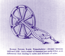
For anyone serving in India during the 19th and early 20th century life …
September 2006
Second International Symposium on Geoinformation and Disaster …


 (5.00 out of 5)