May 2008
IEEE/ION PLANS 2007
Co-sponsored by IEEE and
Institute of Navigation
May 5-8, 2007
Monterey, California, USA
http://www.plansconference.org
June 2008
International conference: “Studying, Modeling and Sense Making of Planet Earth”
1 – 6 June, 2008
Department of Geography,
University of …

ESA confirms SSTL’s GIOVE-A full mission success
GIOVE-A, the first satellite in the Galileo satellite navigation system celebrates 27 months in orbit this month, marking the completion of its nominal mission lifetime. The European Space Agency (ESA) has confirmed that the pioneering Medium-Earth Orbit satellite is a “full mission success” and has contracted SSTL to continue operations for an additional year as the satellite continues to perform and provide valuable Galileo services. Under a 28M euros contract, the 660kg satellite was developed by SSTL for the ESA.
The primary mission was to secure the Galileo frequency filings at the International Telecommunications Union. The satellite also played a crucial role as a test-bed for the Galileo payload units, providing a representative signal-in-space for ground-based experimentation with Galileo signals and characterizing the radiation environment for the Medium Earth Orbit which will be used by all future Galileo satellites. Following successful launch and commissioning, the GIOVE-A team undertook an intensive six-week payload in-orbit test campaign using the 25m dish at the Science Technology and Facilities Council Chilbolton station. Through these activities ESA was able to claim the frequency filings three months before the license expired.
Since commissioning the satellite has achieved a remarkably high operational availability with signals being broadcast for 99.8% of the time over the last year. The primary atomic clock, fundamental to all future Galileo satellites in providing highly accurate positioning and time reference signals, has been operating continuously since June 2007. Thirteen sensor stations around the world are used by ESA to track GIOVE-A and GPS navigation signals and these have demonstrated that Galileo will be a highly accurate navigation system. www.gpsdaily.com

Brazil to deepen Space Cooperation with China
According to Carlos Ganem , head of the Brazilian Space Agency, Brazil will deepen cooperation with China in the field of space technology. The jointly-developed satellite helped Brazil better monitor the deforestation in the Amazon region, which can provide useful information on Brazil’s environmental protection efforts. www.spacedaily.com

“FLAIR Act” introduced in US House
A bill to develop a current, accurate Federal cadastre to inventory all Federal real property has been introduced in the U.S. House of Representatives, earning praise from MAPPS, the national association of private geospatial firms. The FLAIR Act authorizes the Department of the Interior to not only compile an inventory of Federal land ownership but also provides for conducting an inventory of current inventories to eliminate duplication and save tax dollars. www.MAPPS.org.

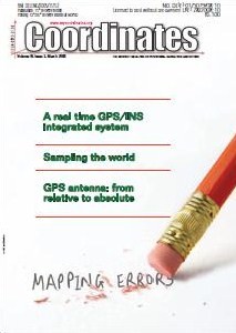
Volume IV, Issue 3, March 2008
Zip
Mapping errors
Dr Beena Chintalapuri, V Raghu Venkataraman
A real-time GPS/INS integrated system
Yong Li, Peter Mumford, Chris Rizos
Science of Interoperability
David Schell, Dr D R F Taylor
Google exposed!
Sampling the world
Rainer Mautz
GPS antenna: from relative to absolute
Aristidis Fotiou, Christos Pikridas, Miltiadis Chatzinikos
My Coordinates
EDITORIAL
News
INDUSTRY …

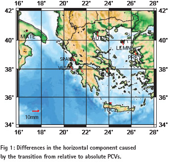
Positioning by GPS can be derived today with a precision of a few millimeters. A GPS receiver determines the distance between the electrical phase center of its antenna and the phase center of a GPS satellite’s transmitting antenna as a pseudorange or a carrier phase observation. It is well known that the phase center of the antenna is not a stable point.

How would the world look like if you were standing on an arbitrary point on earth? It is not easy to imagine, how a randomly chosen location would look like since most pictures that come into our mind are somewhat special: our home, Piccadilly Square, a picture from National Geographic, or a photo that had been taken on top of a famous summit.

Filipo Rodriguez, Gian Paolo Plaia
Application of cognitive psychology for reduction of mapping errors
Human factors contributing to mapping errors made by operators working on digital mapping systems were studied from Cognitive Psychology perspective to evolve suitable strategies to reduce errors.
Mapping errors
Study area
Large scale topographic maps of better than 1:5000 scale with 1 to 2 m contours are …


 (5.00 out of 5)