September 2010
GDI APAC
28-30 September
kuala Lumpur, Malaysia
www.geopatialdefenceasia.com
International Astronautical Congress 2010
27 Sep – 01 Oct
Prague Czech Republic
iac2010@guarant.cz
www.iac2010.cz/en
Geospatial Intelligence Summit
28-30 September 2010
Vienna, Austria
www.jacobfleming.com
October 2010
INTERGEO
5-7 October
Cologne, Germany
www.intergeo.de
3rd Int Conf on Geoinformation Tech for Natural Disaster Management
19-20 October 2010
Chiang Mai, Thailand
http://www.egeinfo.net/git4ndm2010/
GSDI-12 World Conference
19-22 October
Singapore
www.gsdi.org
CANEUS-Shared Small Satellites CSSP Int. Workshop
20-22 Oct
Tuscany, Italy
www.caneus.org/sharedsmallsats
International Symposium on GPS/GNSS
26-28 October
Taipei, Taiwan
http://gnss2010.ncku.edu.tw
November 2010
GEOINT 2010
1-4 November
New Orleans, …

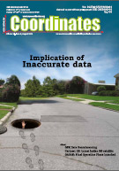
Volume VI, Issue 8, August 2010
Zip
Phase centre determination on the basis of far-field measurements
Nikola Basta, Andriy Konovaltsev and Lukasz A Greda
GPR data georeferencing using photogrammetry and digital maps
Barzaghi Riccardo, Carrion Daniela, Cazzaniga Noemi Emanuela and Forlani Gianfranco
GEO-spatial data accuracy and its legal implications
Adibah Awang, Shahidah Mohd Ariff and Ahmad Fauzi Nordin
Into …

Phase centre is defined as a point (or a set of points) in space from which, when emitted, far-field phasefronts or, correspondingly, group-delay fronts are spherical or substantially spherical [1-2]. That is, the phase value is constant in a certain angular area of interest when measured with respect to the coordinate system whose origin is in the PC. However, PC is ambiguous for most of the real-life antennas and its position varies for…

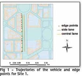
Ground Penetrating Radar (GPR) provides a picture of the different materials or structures underground up to a few meters of depth. To provide a 3D map of underground objects such as pipelines, the georeferencing horizontal tolerance should be around 20 cm, a figure achievable by GNSS systems. The conditions of GPR urban surveys, though, make it impossible to rely on GPS alone for positioning. In front of large blocks…

GIS was first introduced in Malaysia about a decade ago. Amongst the major issues that arose, was the absence or lack of digital geospatial data. GIS users then, needed to digitize their own data from hardcopy maps or survey plans to convert them to digital data. This conversion was certainly time-consuming and expensive, so much so, that accuracy of data was not of paramount importance. At present, with the realization of …

Latest Indian RS Satellite Cartosat-2B and a Dream’ of students
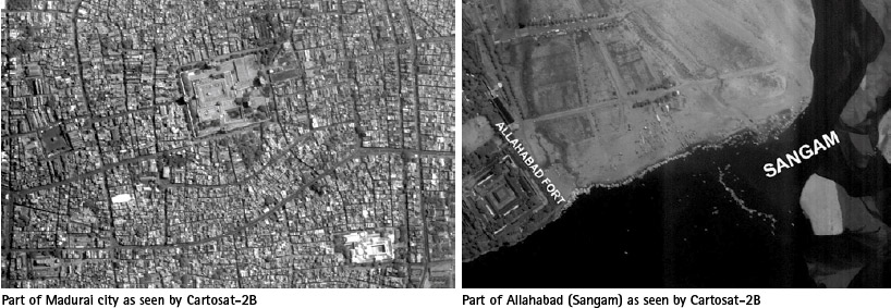
India’s Polar Satellite Launch Vehicle (PSLV-C15) successfully launched CARTOSAT-2B from Satish Dhawan Space Centre (SDSC) SHAR, Sriharikota on 12 July 2010.
In addition to CARTOSAT-2B; PSLV-C15 carried four auxiliary satellites namely STUDSAT a pico-satellite weighing less than 1 kg, built jointly by students from a consortium …

says Shri KR Sridhara Murthi, Managing Director, Antrix Corporation with reference to the Indian Remote Sensing Satellite.
What are the added features in CARTOSAT-2B as compared to CARTOSAT-2A? What will be its marketing strategy?
CARTOSAT-2B is an identical satellite of CARTOSAT-2A and is meant for continuity of services. They are not available for commercial distribution. As …

INDUSTRY | LBS | GPS | GIS | REMOTE SENSING | GALILEO UPDATE
Blue Marble Geographics Desktop 2.2 Blue Marble Geographics has released Desktop 2.2
with Geographic Calculator 7.5 and Geographic Transformer 6.2. It features support for raster DEM like Digital Terrain Elevation Data and USGS Spatial Data Transfer Standard.
www.bluemarblegeo.com
Hexagon acquires Intergraph
Hexagon has acquired Intergraph for …

gis
INDUSTRY | LBS | GPS | GIS | REMOTE SENSING | GALILEO UPDATE
ArcGIS 10 from ESRI
ArcGIS 10 release makes it much easier to see data in 3D and introduces the notion of time in both visualization and analysis. Users can create, manage, and visualize time-aware data. They can also display and animate temporal datasets …

INDUSTRY | LBS | GPS | GIS | REMOTE SENSING | GALILEO UPDATE
DigitalGlobe: High-resolution imagery for handheld GPS, releases Ortho Product Series
DigitalGlobe is to provide high-resolution imagery for DeLorme’s Earthmate series, including the PN-30, PN-40 and PN-60 models. Hikers, climbers and other outdoor enthusiasts will be able to update their GPS device with accurate …


 (5.00 out of 5)