January 2012:
ION International Technical Meeting,
30 Jan-1 Feb,California, United States (USA),
http://ion.org/meetings

The bottom line is that the LightSquared signals interfere with GPS, and LightSquared should not be allowed to proceed until the interference problems are resolved. To understand this perspective, some background is useful. The spectrum allocated to GPS for its L1 signal is from 1559 MHz to 1591 MHZ. This spectrum is shared by other Global Navigation Satellite Systems such as the EU’s Galileo, China’s Compass, and shortly also by Russia’s GLONASS, which uses the 1598 MHz to 1605 MHz band for its present signals. Basically, GNSS signals occupy the 1559 MHz – 1605 MHz band.

The economic and social development in the Sultanate of Oman during and after 1970 became the basis of assessment and planning to identify priorities of national development. For this, the role of geographic data to support sound decisionmaking has been considered important to support development programmes. Thus, the framework of dataset or the fundamental data in the Sultanate needs to clearly identify what constitutes the basic data used and produced by the government and private institutions.

The importance of good land governance to strengthen women’s land rights, facilitate land-related investment, transfer land to better uses, use it as collateral, and allow effective decentralization through collection of property taxes has long been recognized. The challenges posed by recent global developments, especially urbanization, increased and more volatile food prices, and climate change have raised the profile of land and the need for countries to have appropriate land policies.

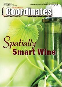
Precision viticulture (PV) is styled from the zonal management paradigm of precision agriculture, where large homogeneous fields are divided into smaller units based on yield or other field characteristics which may be differentially managed (Lamb et al., 2002, Bramley, 2009, Bramley and Robert, 2003) (Note that McBratney et al. (2005) suggest the definition of precision agriculture is continually evolving as we develop further technologies and greater awareness of agricultural processes). PV acknowledges the numerous spatial variations that affect grape quality and yield, including soil characteristics, pests and diseases and topography (Hall et al., 2003, Arnó et al., 2009), providing land managers with the tools to quantify and manage this variability (Proffitt, 2006). Land managers can thus ‘selectively’ treat areas, for example by the variable application of mulch, water, fertiliser, sprays etc.

The most important achievement of the National Spatial Data Infrastructure (NSDI) has been bringing together many agencies to work for a cause. It had not been easy and it took more than ten years to reach at this stage. In addition, we were involved in the standards development activities of NSDI for Metadata (2005/2009) and National Spatial Data Exchange Standards (NSDE- 2003). NSDI is seen as Standards organization and Bureau of Indian Standards (BIS) is in the process of constituting a mirror committee for ISO TC 211 with NSDI as anchor.

GIS is becoming pervasive and is finding applications across a wide range of applications across the globe. It is becoming an effective language for communication. GIS companies like Esri are leveraging the advancements in information and communication technology and implementing GIS in multiple patterns like desk top, client server, federated, Web/Cloud and Mobile.
Over 650 years of experience in spatial information management, land administration and spatial enablement were percolated into 22 presentations offering a raft of initiatives and insights across the world corresponding with the theme of the forum, “Beyond Spatial Enablement’- Land Administration to support Spatially Enabled Government”


 (5.00 out of 5)