Geological researches have increased the utilization of tridimensional models in the last years in order to make possible visualization, parametrization and interpretation of data. The LIDAR technique allows to acquire a huge amount of georeferrenced data using a Terrestrial Laser Scanner (TLS). Both fastness and accuracy are the main characteristics of this equipment. Its utilization in geological studies has started in the last decade (Bellian et al., 2002), but only in the last years the number of scientifi c articles has increased signifi cantly. The TLS acquires georeferrenced point clouds that can be converted in digital models after processing, especially digital outcrop models (DOM).

The discussions in the United States among LightSquared, the Federal Communications Commission (FCC), the Global Positioning System (GPS) industry, Department of Defence (DoD), Department of Transportation (DoT) and users about the division of spectrum in the L-band should not be seen as just an internal US affair. The strength of both the camps, Telecom providers and the GPS industry indicate that this battle may easily expand to other parts of the world. For many, this battle was a surprise, particularly for a peaceful world like navigation, where discussions are more gentlemen like and either focused on which GNSS systems is the best, or on the backup of GNSS which is so vulnerable and where society cannot function anymore without GNSS. All this changed abruptly when LightSquared published plans to install 40,000 transmitters in a band adjacent to L1 band used by GPS. This led to numerous protests in the GPS industry and among its users as what has been published in many magazines. It is for us to see whether it is telecom versus GPS, or is there a sensible cooperation in reach?
CHC has announced the availability of X900 GNSS receiver bringing extremely affordable and reliable GPS+GLONASS real-time centimeter level solution to surveyors without the conventional cost associated with GNSS solutions. The X900 GNSS combines fi eld proven 72 channels GPS+GLONASS technology and state-of-the-art RTK solution for either traditional base + rover confi guration and RTK networks thanks to its fl exible GPRS and UHF communication systems. The X900 is available in various bundled packages to fi t end users need with choice of various data collection software and handheld controllers.
Europe’s Galileo system has passed its latest milestone, transmitting its very fi rst test navigation signal back to Earth. According European Space Agency (ESA), the different Galileo signals are being activated and tested one by one. Soon after the payload power amplifi ers were switched on and ‘outgassed’– warmed up to release vapours that might otherwise interfere with operations – the fi rst test signal was captured at Redu. The test signal was transmitted in the ‘E1’ band, which will be used for Galileo’s Open Service once the system begins initial operations in 2014. The Open Service will be freely available to users all over the world. This signal is particularly important because it shares the ‘L1’ band of the US GPS navigation satellites.
Bhuvan, ISRO’s geoportal and gateway to Indian earth-observation data products and services, announced that now users can select, browse and query the thematic datasets from its website. Users can also use these thematic datasets and integrate them into their systems as OGC web services. At present, Land Use Land Cover (LULC) 50K : 2005-2006, datasets are available on the website. It can be accessed from the link provided at the Bhuvan home page (www.bhuvan.nrsc. gov.in) or accessed directly from http:// bhuvan-noeda.nrsc.gov.in/theme
INDUSTRY | LBS | GPS | GIS | REMOTE SENSING | GALILEO UPDATE
China, UK build geospatial research center
The Sino-British Geospatial Information Research Centre, jointly built by the China Academy of Surveying and Mapping and U.K. University of Nottingham, opened in Beijing on Dec. 13. This research centre will develop geospatial information research to solve …

The UK’s Information Commissioner’s Offi ce (ICO) voiced concerns over the growing pervasiveness of LBS and the lack of end user awareness about how much data these systems transmit. According to Jonathan Bamford, Head of strategic liaison at the data protection watchdog, the speed of development in this sector leaves regulators struggling to ensure that the necessary safeguards are in place. “The sheer scale of technological change and the ingenuity with which people are using LBS data feeds means we are always playing catch-up,”

Indeed, the successful launch of two Galileo satellites on 21 October 2011 from French Guyana was a key step for the programme. Galileo is now becoming a reality and I am really proud of it. The EU, with its partners, in particular the European Space Agency, has demonstrated its ability to manage such a large scale programme. We are reaping the fruits of our continuous efforts. The programme is under control both on programmatic and fi nancial levels and it is now possible to accelerate the deployment of the constellation of satellites. That is why I have decided to buy additional satellites.

7 – 8 December 2011, Noida, India
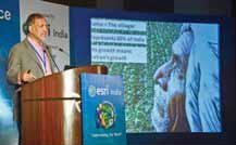
Mr Rajendra S Pawar addressing the conference
The 12th Annual Esri India User Conference was a big hit with Users and Partners from across all spectrums of GIS Users. Held at the Radisson Blu MBD Hotel at Noida on Dec. 7th & 8th, 2011. It was a resounding success for …


 (5.00 out of 5)