By definition, ‘spatial enablement in action’ means that we (governments) must make our spatial information “actionable”. That is, it must be used and leveraged beyond just for mapping. It must form the enduring fundamental authoritative spatial data layers of a nation, and do so in a way so that it is able to support evidence-based decision making for the many social, economic and environmental drivers challenges that face our Governments. It is incumbent on us doing so. Should we not do so, we seriously risk “spatial stagnation”, and have a rich resource of geoinformation that remains largely untapped and with significant unrealised potential.
April 2012
6th International Satellite Navigation Forum, 17-18 April, 2012,
Moscow, Russia, https://mycoordinates.org/the-6thinternational-satellite-navigation-forum/;
Interexpo Geo-Siberia, 17-19 April, 2012,
Novosibirsk, Russia, http://itcsib.ru/event/4-INTEREKSPO_GEO-SIBIR;

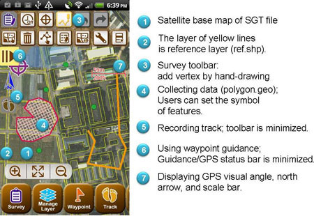
SuperGeo Technologies, the leading global provider of complete GIS software and solutions, released SuperSurv 3, supporting bilingual user interface, traditional Chinese and English, and global coordinate system. SuperSurv 3 is the mobile survey system that can be operated on Android mobile devices.
SuperSurv 3 mainly offers users with the convenience of data collection in field survey …

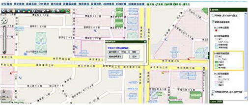
SuperGeo Technologies, the leading global provider of complete GIS software and solutions, recently cooperates with Asia Pacific Telecom which utilizes SuperGIS Server 3 to establish an intranet-based service platform to effectively manage and integrate various types of GIS resources.
Employing SuperGIS Server 3 as the core of the GIS platform and SQL Server 2008 as the …

SuperGeo Technologies, the leading global provider of complete GIS software and solutions, will release SuperGIS Spatial Analyst 3.0 by end of January, 2012. The newly-launched SuperGIS Spatial Analyst 3.0 offers a range of spatial modeling and analysis algorithms and a user-friendly interface to help users accomplish massive and complicated spatial analysis tasks.
With SuperGIS Spatial analyst …

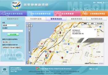
SuperGeo Technologies, the leading global provider of complete GIS software and solutions, assisted the Miaoli Public Health Bureau, Taiwan in establishing Health Resource Network with SuperGIS Server 3, which allows the department to publish integrated healthy information online for both internal and public use.
With the development of geographic information, the Miaoli Public Health Bureau, Taiwan …
Today, Hemisphere GPS and Carlson Software announced a strategic alliance. This alliance will provide a roadmap for new, integrated solutions for land survey, mapping, construction, mining and other key machine control markets. Carlson Software is a leading developer of field and office-based land development software.
This strategic alliance is part of Hemisphere GPS’s recent formation of …
Trimble (NASDAQ: TRMB) announced today that the El Paso Water Utilities in Texas has successfully implemented Trimble® Fieldport® software to enhance its utility field operations. The Trimble Fieldport software is an interactive Geographic Information System (GIS) map-based mobile work management solution for utility field workers.
“El Paso Water Utilities is committed to improving our efficiencies, reducing costs …
IFEN, the leading manufacturer of GNSS navigation products and services, working in partnership with WORK Microwave, a leading European manufacturer of advanced satellite communications and navigation equipment, today announced an enhanced version of its NavX®-NCS Professional, a multi-frequency simulator, which is optimized for research and development of GNSS safety and professional applications. The NavX®-NCS range of simulators also includes …


 (5.00 out of 5)