ITT Exelis Geospatial Systems has delivered GeoEye’s next-generation commercial imaging system for the GeoEye-2 satellite to Lockheed Martin Space Systems Company in Sunnyvale, Calif. When operational in 2013, GeoEye-2 will deliver the highest resolution and most accurate color imagery to GeoEye’s commercial, government and international customers.
Remote sensing solutions provider DMC International Imaging Ltd (DMCii) has signed a contract with Brazil’s National Institute for Space Research (INPE) to deliver near real-time satellite imagery to monitor forest clearing in the Amazon rainforest and target illegal logging as it happens.
As part of the National Space Technology Programme, the UK Government will grant nearly GBP 6 million to co-fund major new research projects that will develop commercial products and services using space technology and data from space-based systems.
In a project for which the budget allocated is Rs 6 crore, officials from the Tree Authority will also note details of the tree, right from identifying its biological name to minute details such as girth, height and life expectancy and upload them on their server along with their GPS markers. The trees’ latest photographs will also be uploaded, which will help the officials identify them with greater ease the next time.

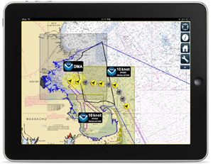
For the first time, mariners operating along the U.S. east coast can receive a visual display of all relevant right whale management initiatives and warnings via their iPad or iPhone, including Seasonal and Dynamic Management Areas, Mandatory Ship Reporting areas, recommended routes, and automatic whale alerts triggered by acoustic detection buoys.
The regional GLONASS centre will be processing information received from school buses, health-care vehicles, and trucks transporting hazardous cargo. In the long run, the system is expected to secure safety of transportation services as such.

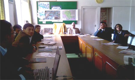
Mr. Basanta Shrestha gave introductory remarks on the system and highlighted its usefulness in the Nepalese context. Mr. Sudip Pradhan presented and demonstrated the MODIS based forest fire detection and monitoring system to the attendants. The Honorable Secretary and other officials showed keen interest in the system and decided to subscribe for fire alerts.
Earlier he attended the ‘Curtin Sarawak Malaysia (CSM) University-DBNA roadshow’ that was launched by the association advisor and also Infrastructure Development and Communication Minister, Dato Sri Michael Manyin. Highlighting that the self-initiative is already a proven success to those who had taken the effort, Ik Pahon encouraged all communities throughout the state to start their survey as well.
The project has been made possible through funding from the National VET E-learning Strategy, whose Peak Industry Bodies Programs sponsors the adoption of e-learning growth opportunities at the level of whole industries through their peak bodies or associations.


 (5.00 out of 5)