Vol. IX, Issue 6, June 2013
Zip
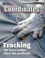
Tracking the prey rather than the predator with GNSS
Dr Volker Janssen
Integrating surveying methodologies to provide specific solutions
Donatella Dominici, Elisa Rosciano, Michail Elaiopoulos
Improving land administration systems in developing countries
Jouni Johannes Anttonen
Geodynamical study of the territory of Balkan peninsula from GPS solutions
Keranka Vassileva
A hybrid GIS space syntax …
July 2013
GI Forum 2013
2 – 5 July
Salzburg, Austria
www.gi-forum.org
Survey Summit
6 – 9 July
San Diego, USA
www.esri.com/events/surveysummit/index.htm
CASLE International conference on Management of Land and Sea Resources
7-10 July
Glasgow, Scotland
www.casle.org
Esri International User Conference
8 – 12 July
San Diego, USA
www.esri.com
ESA International Summer School on GNSS 2013
15 – 25 July
Davos, Switzerland
www.congrexprojects.com/13m07
IGNSS 2013
16-18 July
Gold Coast, Australia
www.ignss.org
International Geoscience and Remote Sensing Symposium (IGARSS 2013)
22-26 July
Melbourne, …

Convergence – The mantra
The mobile phone has it all.
Camera, music, LBS, Internet, wireless, TV,…
Many such functions were not imagined
When mobile was invented
As its mobility in itself was a major technological leap.
The positioning and navigation technologies
Appear to be following the similar logical transitions
Where in various positioning tools and functionalities
Not only of within the domain but from …

Slums in Egypt – as in many developing countries – are considered as one of the most important problems in Egypt. There are about 1,100 slum areas hosting about 16 million inhabitants. Slums in Egypt vary considerably in their characteristics which make prioritization and intervention policy a debatable issue.

The territory of the Balkan Peninsula (BP) is one of the most active geodynamical regions in Europe. Numbers of publications are devoted to this problem. An important indicator in geodynamical point of view is an eventual station movement of GNSS network stations. Determination of the size and direction of the vectors of movement, their analysis and assessment is of significant importance for their further interpretation with a view to present the geodynamical picture of the region.

During the ultra-communist Khmer Rouge regime (1975-79) in Cambodia, the private ownership of land was abolished and it remained unrecognized also during the following 10-year long Vietnamese-backed Communist government (1979-89). All land-related documents, including the land register, maps and geodetic networks were systematically destroyed as well as most professionals and educated people eliminated during the tragic 1975-79 period.

Global Navigation Satellite System (GNSS) technology has revolutionised the way 3-dimensional positions are determined on and above the Earth’s surface. GNSS-based positioning has become a vital tool for a wide range of applications in areas such as surveying, mapping, asset management, precision agriculture, engineering and construction. A lesser known application that has benefited immensely from the introduction of GNSS technology is animal tracking.
INDUSTRY | LBS | GNSS | GIS | IMAGING | GALILEO UPDATE
R330™ GNSS receiver by Hemisphere GNSS
Hemisphere GNSS has launched the new R330 GNSS receiver, a versatile, fully featured positioning system. It delivers accurate and robust positioning through a variety of differential correction methods including SBAS, L-Band, Beacon and RTK. The wide range of …
INDUSTRY | LBS | GNSS | GIS | IMAGING | GALILEO UPDATE
ISRO Navigation Centre near Bangalore unveiled
Indian Space Research Organisation has unveiled its Navigation Centre in Bangalore Rural District for the proposed Indian Regional Navigation Satellite System (IRNSS), a constellation of seven spacecrafts that will enable users to know their location and …


 (5.00 out of 5)