Yamuna is the identity of Delhi. While the immediate cleaning operations include trash skimming, weed harvesting and dredging, these will have to be long-term, overarching the entire region
A. K. Jain
Worked as Commissioner (Planning), Delhi Development Authority and as a member of the Committee of the Ministry of Housing and Urban Affairs on the DDA (2015). …

Volume 21, Issue 4, April 2025
The growing importance of geospatial technology and challenges
T Vijayalakshmi
GNSS Constellation specific monthly analysis summary: March 2025
Narayan Dhital
Impacts of climate and land use/cover changes on the sustainability of irrigation water in West Africa: a systematic review
Gemechu Fufa Arfasa, Ebenezer Owusu-Sekyere, Dzigbodi Azdo Doke and Justice Ayegi Ampofo
My Coordinates
EDITORIAL
News
GNSS …
Segway expands Navimow lineup with X3 Series launch
Segway Navimow has launched the X3 Series, the latest addition to its portfolio of boundary-cord-free robotic lawnmowers. The range consists of four new models – the X315, X330, X350 and X390 – and is designed to handle unprecedented lawn sizes with precision, mowing areas of up to 10,000m² …
May 2025
2nd Annual International Geotechnical Innovation Conference
5th – 6th May 2025
Jeddah, Saudi Arabia
https://rin.org.uk
17th Baška GNSS Conference
11-15 May 2025
Baška, Croatia
https://rin.org.uk
Geolgnite
12-14 May 2025
Ottawa, Canada
https://geoignite.ca
European Navigation Conference
21-23, May 2025
…
Disaster response with satellite technology
Juvare and ICEYE have announced a strategic partnership designed to deliver unprecedented situational awareness and actionable insights to emergency management agencies, insurers, and government organizations worldwide. Through this collaboration, ICEYE’s high-resolution, all-weather satellite solutions will be integrated into Juvare’s …

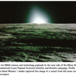
NASA science continues after Firefly’s Afirst moon mission concludes
After landing on the Moon with NASA science and technology demonstrations March 2, Firefly Aerospace’s Blue Ghost Mission 1 concluded its mission March 16. Analysis of data returned to Earth from the NASA instruments continues, benefitting future lunar missions.
As part of NASA’s CLPS (Commercial Lunar Payload Services) …

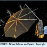
UK Positioning, Navigation and Timing: Overview
As of March 2025, the UK’s Framework for Greater PNT Resilience, introduced in October 2023, continues to drive efforts to enhance Positioning, Navigation, and Timing (PNT) services. A significant milestone was achieved on 20 November 2024, when the National PNT Office, established within the Department for Science, Innovation and Technology …
AIBOT achieves eVTOL milestone at Norton
AIBOT has successfully conducted a f light test at the Unmanned Aircraft Systems (UAS) Center at San Bernardino International Airport (SBD) under the newly established Norton Test Range. The flight was conducted through a partnership with the FAA’s UAS Test …
FCC launches proceeding on GPS alternatives
The Federal Communications Commission (FCC) recently launched an inquiry to explore commercial technologies that would complement the Global Positioning System (GPS). Although GPS is indispensable to America’s economic and national security, it represents a single point of …


 (5.00 out of 5)