

Volume 22, Issue 3, March 2026
Will the Agentic AI rewrite the rules of geospatial intelligence?
Nirmalendu Kumar
GNSS Constellation Specific Monthly Analysis Summary: February 2026
Narayan Dhital
Time-Base Accuracy Evaluation of Static, RTK, and PPK Surveys in Differential GNSS
Siba Prasad Mishra, Kamal Kumar Barik, Rabindra Nath Nanda and Kumar Ch. Sethi
Risk-informed spatial planning of …
April 2026
Assured PNT Summit
7 – 8 April 2026
Washington DC, USA
https://pnt.dsigroup.org
Pacific PNT conference
13 – 16, April 2026
Honolulu, Hawaii
https://www.ion.org
2026 Commercial UAV Forum
22 – 23 April
Amsterdam, The Netherlands
www.forumuav.com
European Navigation Conference 2026
28 – 30 April 2026
Vienna, Austria
https://enc-series.org
May 2026
GeoIgnite 2026
11 – 13, May
Ottawa, Canada
https://geoignite.ca
EUROGEO conference
21 -223, May
Tilburg, Netherlands
www.eurogeography.eu
GISTAM 2026
21-23 May
Benidorm, Spain
https://gistam.scitevents.org
FIG 2026
24 – 29 May
Cape Town, South Africa
https://fig2026.org
June …
GNSS protection system by InfiniDome
InfiniDome is set to debut its Aura GNSS protection system. It supports two to four antennas and protects two GNSS frequency bands while passing two additional bands. The system can generate up to three nulls per protected band, allowing it to suppress multiple interference sources at once. The product is offered …
Navigation with Indian Constellation is down!
India’s indigenous satellite navigation system, Navigation with Indian Constellation (NavIC), is facing scrutiny after reports that an atomic clock onboard one of its satellites has stopped functioning, raising concerns about the reliability of the country’s homegrown positioning network.
“IRNSS-1F satellite, launched …
Bachelor’s-level geospatial intelligence programme by NUS
The National University of Singapore (NUS) will offer a new major in geospatial intelligence that will train students to harness geospatial data and emerging technologies such as artificial intelligence (AI). NUS’ new Bachelor of Science (Honours) in Geospatial Intelligence Cross-Disciplinary Programme …
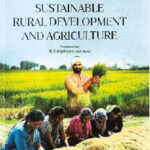
Sustainable Rural Development and Agriculture
The book ‘Sustainable Rural Development and Agriculture’ by Ashok Kumar Jain highlights the role of rural development and agriculture in making Viksit Bharat The agriculture sector in India contributes about 17.4% of GDP and engages 55% of India’s workforce. On the other hand, urban sector contributes the GDP about 4 times …
China launches Yaogan satellite
China conducted a pair of launches sending a second Yaogan-50 satellite into a highly retrograde orbit and completing a Kuaizhou-11 solid rocket rideshare mission. A Long March 6A rocket lifted off at 8:22 a.m. Eastern (1322 UTC) March 15 from Taiyuan Satellite Launch Center …

India’s quest for strategic autonomy in navigation gave birth
to Navigation with Indian Constellation (NavIC).
It was never merely a technological project.
It was a statement of sovereignty in positioning, navigation and timing.
The recent failure of the atomic clock onboard IRNSS-1F
Is therefore, more than a technical glitch.
It exposes the fragility of a system still in transition.
Global dependence on …

A Geospatial assessment of urban expansion suitability using multi-criteria framework
Shashi Shekhar
Scientific Officer, Himachal Pradesh State Pollution Control Board
Abstract
Rapid urbanization in fragile Himalayan ecosystems necessitates robust land-use planning that balances development needs with environmental conservation. This study utilizes a Multi-Criteria Decision Support (MCDS) system, implemented via the Weighted Linear Combination (WLC) method within the Google Earth …


 (5.00 out of 5)