

The polar regions aside, access to highly accurate positioning, navigation and timing (PNT) data opens up enormous potential for economic growth, reduced inequality, and international co-operation. Access to Global Navigation Satellite System (GNSS) has become a fundamental expectation and mainstay of the modern world.
The Indian Army has signed an approximately $20 million contract for undisclosed quantities of a high-altitude variant of ideaForge’s SWITCH UAV which will be delivered over a period of 1 year. ideaForge has been awarded this contract after it emerged as the only vendor that qualified the operational requirements in an evaluation done in real-world conditions, for …
TomTom (TOM2), the leading independent location technology specialist, has announced that its full stack of navigation components – maps, connected navigation, and real-time traffic services – has been chosen by Mitsubishi Motors to power the new Eclipse Cross’ infotainment system. The restyled SUV is the latest Mitsubishi model to be equipped with TomTom’s automotive-grade solution; …
PointFuse launches ‘PointFuse Pro’
PointFuse software which enables the fast, easy creation of intelligent mesh models of any environment from point cloud data has extended its product portfolio in tandem with the latest release going live, version 2020.02. Available immediately following research with current customers, a new version of the software has been created called …
Volume XVI, Issue 12, December 2020
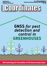
GREENPATROL: A Galileo Enhanced Solution for Pest Detection and Control in Greenhouses with Autonomous Service Robots
Michael Pattinson, Smita Tiwari, María Camp o-Cossio, Raúl Arnau, David Obregón, Aitor Gutierrez, Iker Lluvia, Jon Martin, Oscar Rey, Dalibor Huska, Libor Lenža, Olga Kryštofová, Tamm e van der Wal, Bauke Abma, Jeroen
Verschoore and Joaquin …
Klau Geomatics releases GNSS/ IMU hardware and software integration platform
Klau Geomatics is releasing the 7700C integration platform, a GNSS hardware system designed to integrate with external IMUs and IoT devices.
The KlauPPK hardware/software product has been an industry leader in aerial mapping for over 5 years, with ongoing improvements leading to the release of the 7700C. …
Discussion draft of the National Unmanned Aircraft System (UAS)
The Government of India has released the discussion draft of the National Unmanned Aircraft System (UAS) Traffic Management Policy framed by the UTM Committee constituted under the Ministry of Civil Aviation. This policy is drafted under the overarching framework of the Draft UAS Rules 2020 and …
Remote sensing data based on neural networks
Russia’s State Space Corporation Roscosmos will launch the experimental operation of its services for processing the Earth’s remote sensing data based on neural networks, according to Roscosmos representative Denis Shvedov.
This year, Roscosmos has established the Forest Control, Quarries, Disturbed Lands, Construction Control, Emergencies and Agricultural Monitoring services, …
Galileo nominal service restored
The Galileo Service was affected from Dec 14, 00:00 UTC by an anomaly in the time determination function of the ground segment of the system.
This resulted in signals flagged as MARGINAL (SISA=NAPA) for all satellites. During this period, pseudorange errors in excess of nominal performance were experienced by user receivers. …
All Americans benefit from a competitive 5G landscape, and that goal can be achieved without undermining U.S. Global Positioning System receivers and devices
J. David Grossman
Executive Director of the GPS Innovation Alliance
The “race to 5G” continues to dominate news headlines, congressional hearings and the attention of U.S. federal agencies — and rightfully so. With faster speeds, …


 (5.00 out of 5)