
East View Cartographic announced it has become an official reseller of paper and digital geospatial products produced by the National Land Agency in Jamaica. This agreement allows EVC to sell digital raster versions of the 20 sheet 1:50,000 topographic map series and the 1:250,000 single sheet map sheet that covers the entire country. EVC has …
Leica Geosystems’ announced the availability of the complete new Leica Zeno GIS products within the Leica Viva family targeting the data collection market. The Leica Zeno GIS offers a multi-functional and easy GNSS/GIS solution. Leica Zeno GIS provides a one-click automated workflow between the field and office.
The Leica Zeno 10 provides a colour graphic display …
PCI Geomatics announced the availability of an upgrade to its remote sensing and image processing software Geomatica®. Version 10.3.1 is the latest release available which includes imaging tools for GIS as well as additional satellite and aerial sensor support.
Satellites fully supported in this release include THEOS (Thailand Earth Observation System), GOSAT (Greenhouse Gases Observing Satellite), …

Vol. VI, Issue 2, Feb 2010
Zip
Defining civil PNT requirements
John W Lavrakas
MISSION 2020: Land Titling Project
P Misra
GNSS support to canine search and rescue
José Caro and Manuel Prieto
Fuzzy strong tracking unscented
Kalman filter
Dah-Jing Jwo, Fong-Chi Chung and Shih-Yao Lai
My Coordinates
EDITORIAL
Book
Land administration for sustainable development
Conference
The First Asia Oceania Regional Workshop, Survey camp
News
INDUSTRY | GPS | GALILEO UPDATE | …
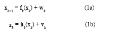
The Global Positioning System(GPS) (Brown and Hwang 1997; Farrell and Barth 1999; Gelb 1974) and inertial navigation system (INS) have complementary operational characteristics and the synergy of both systems has been widely explored. An integrated GPS/INS system is typically carried out through the extended Kalman filter (EKF). The EKF is the approximate nonlinear filters which linearizes the system…

Earthquakes, landslides, avalanches, collapsed buildings… There are many situations in which people could suddenly become trapped and unable to free themselves without the assistance of search and rescue professionals…
Bentley Systems announced breakthroughs in 3D GIS software to support the design and operation of intelligent cities. Bentley’s intra-operable portfolio of software features lifecycle support across all classes of intelligent infrastructure, including land management, power generation and energy delivery, water and wastewater networks, roads, bridges, rail, communications networks, and buildings. The just-released V8i versions of …
AND (Automotive Navigation Data – Netherlands), EMG (China) and Orion (Dubai) received approval from their respective boards to join forces regarding their participation and contribution to the foundation of a Global Digital Mapping Alliance (GDMA) which will establish its Coordination centre / Head office in the Netherlands. The first objective of GDMA is a feasibility …
The Republic of Croatia has simplified access to countrywide geographic data through an online geoportal, a type of Web site that makes it easier for citizens, government, and private-sector users to find and access vast quantities of geographic information and related services. The geoportal has already proven its value as an essential component of the …
Geologists from GNS Science will spend the next six months collecting information on buildings and other infrastructure in Pacific Island countries to measure vulnerability and risk from earthquakes and cyclones in the southwest Pacific. Project leader, Phil Glassey of GNS Science said, data would be collected in a form that could be used in any …


 (5.00 out of 5)