Articles in the Mycoordinates Category

MICHIBIKI
Asia seems to be emerging.
As a new centre for satellite navigation.
China is moving fast.
India is maintaining its own pace.
Now Japan is set to touch the zenith.
With the scheduled launch of MICHIBIKI.
The first satellite of Quasi-Zenith Satellite System (QZSS).
A landmark in the regional navigation system.
The sun rises.
Again in the East.
Bal Krishna, Editor
bal@mycoordinates.org
Tweet

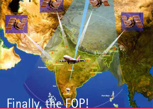
India has launched the Final Operation Phase (FOP) of GAGAN.
The process of certification for aviation use is expected to be completed by 2013.
As a very large user segment in this region awaits.
Air navigation space in and around India is set to be redefined.
With many more applications beyond aviation.
In a multi-GNSS world,
India strives to be a …

It is not the strongest,
Nor the most intelligent,
But the ones most responsive to change,
Survive.
So said Darwin.
With the advent of new species – Smart Phones, MIDs..
The landscape of satellite navigation industry is changing.
Once considered a powerful and promising navigation force,
The space of PND appears to be shrinking.
Probably there is a need to adapt.
And evolve.
Bal Krishna, Editor
bal@mycoordinates.org
Tweet

Nature strikes at will.
Some areas and people are better prepared.
Some are not.
Haiti is a case in point.
Poor infrastructure.
Inadequately trained personnel.
Weak cooperation among institutions.
And the situation worsened
When the earthquake struck.
Tremendous efforts have been made.
And are being made.
Still.
Any lesson learnt?
Bal Krishna, Editor
bal@mycoordinates.org
Tweet

Do you know…
That I know…
The process.
To determine positions.
Accurate positions.
Of ‘what’ and ‘where’.
On and around this Earth.
I prepare the foundation.
The basics of ‘knowledge’.
On which much can be built.
I play a role.
A very important role.
Who am I?
I know that you know.
Still, I reiterate.
That I am a surveyor.
Bal Krishna, Editor
bal@mycoordinates.org
Tweet

It is not a GNSS race.
It is about space.
Capturing the space.
It is not about the ‘rules’ of the race.
It is about ‘who will rule’.
It is not about ‘roles’.
It is about ‘controls’.
It is not about wrongs and ‘rights’.
It is about ‘the rights’.
.. It is about might, only, the might.
Bal Krishna, Editor
bal@mycoordinates.org
Tweet
Haiti shocks sent reminders.
With around 2,00,000 dead and 3,00,00 injured.
About the nature’s might and fury.
We feel helpless again.
And look up to the government, systems, technology, experts, …
For assistance, actions, accountability and response.
Still, the questions remain.
Can disaster prediction be more than just guesswork?
Can disaster preparedness be more than just a term?
Can response to disasters be quick …

Decade of Innovations – 2010 – 2020
The Government of India has declared so.
Indian Science needs money.
It also needs a change in mindset.
The country needs to develop an innovation eco-system.
Where innovators can produce newer solutions.
To meet the needs of society.
However, the need is to liberate Indian science.
From the shackles and deadweight of bureaucracy and in-house favouritism.
The …


 (5.00 out of 5)