

Vexcel Imaging to acquire Image Resources from Verisk
Vexcel Imaging, a leader in aerial imagery data, large-format aerial cameras, and photogrammetry software, signed a definitive agreement on 21st Jan 2020, to acquire the imagery sourcing group from Verisk’s Geomni business. The acquisition will combine Geomni’s imagery surveying and content-related teams and assets into Vexcel. Verisk, …
KazUAV supports World Bank’s school infrastructure risk assessment initiative
KazUAV, a group company of Japanbased Terra Drone Corporation, has been supporting the World Bank in its initiative to build sustainable school infrastructure in the Republic of Kyrgyzstan. As part of the General-Purpose Simulation Program (GPSS) under the Global Facility for Disaster Reduction and Recovery (GFDRR) …
Agreement on data utilization of EOS with FAO
Japan Aerospace Exploration Agency has agreed to collaborate with Food and Agriculture Organization of the United Nations (FAO) on data utilization of Earth Observation Satellites(EOS), and Imai Ryoichi, JAXA Vice President and Daniel Gustafson, FAO’s Deputy Director- General for Programmes have signed the Memorandum of Understanding at …
ISRO’s NavIC will support Qualcomm
Qualcomm has released three new chipsets that will come with support for India’s NavIC satellites — developed by ISRO. Support for NavIC will be seen on Qualcomm’s latest Snapdragon 720G, 662 and 460. These are budget to midtier performing chipsets that will be seen on upcoming budget-friendly smartphones. www.indiatimes.com
Galileo …
Iridium Cloud Connect goes live
Iridium Communications Inc. has announced that Iridium CloudConnect, the first and only satellite cloud-based solution offering truly global coverage for Internet of Things (IoT) applications, is now actively serving customers. This new service combines Iridium® IoT capabilities with Amazon Web Services (AWS) IoT and cloud services extending customers’ IoT reach …
Blue Marble Geographics announces partnership with COPTRZ
Blue Marble Geographics® has announced its first official partnership with a UK GIS-focused company — COPTRZ, UK Commercial Drone Experts. Providing comprehensive support to businesses interested in using drones, COPTRZ will now include Blue Marble’s GIS software and point cloud processing software Global Mapper® and the LiDAR Module® …

What is the relevance and importance of this workshop?
Today, geospatial technology extends into virtually all areas of human activity….
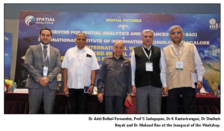
“India has been at the forefront at some unique systems like NRDMS, NRIS, NSDI, National GIS, etc.” said Dr K Kasturirangan, Former Chairman ISRO…

Today, information is key to the success of a citizen, society, governments and humanity as a whole. Our government’s vision is…

Global Navigation Satellite System (GNSS) is one of the best finding of the twenty century world technologies…


 (5.00 out of 5)