


Spatial relations are explicitly modelled using spatial weighting matrices which can be applied to the dependent, independent or error terms in regressions
Eduardo Zegarra
Group for the Analysis of Development (GRADE), Lima, Perú
Abstract
The potential existence of spatial dependencies in land use and irrigation access in mountainous areas like the Peruvian Andes is a relevant issue for designing …

Cyclone ‘Tauktae’ hit the Gujarat coast, India on May 17, 2021, which affected the Gir National Park, a wildlife sanctuary for Asiatic lions. In order to do a quick assessment of the affected area, a suite of optical and microwave satellite datasets were analysed for pre and post cyclone periods
Dr C P Singh
Scientist/Engineer- SF Biological …

This paper highlights amusing research related to the animal kingdom, improving our understanding of animal behaviour, ecology and conservation, often by employing spatial tools and innovative approaches to data collection and analysis.
Volker Janssen
Publications Officer, Association of Public Authority Surveyors (APAS), New South Wales, Australia
This is the fourth in a series of papers celebrating some of …

Maj Gen (Dr) B Nagarajan
Professor, Department of Civil Engineering, Indian Institute of Technology (IIT) Kanpur, Kanpur, India
Why is geodesy an indispensable science? How it has evolved over the years?
Geodesy is the science of accurately measuring and understanding the three fundamental properties of the Earth: its geometric shape, its orientation in space, and its gravity field. …

Volume XVII, Issue 10, October 2021
Modernization of land administration services in Uganda
Richard Oput
COVID-19 and the role of digital technology based on the ten global trends identified by the World Economic Forum
Rishiraj Dutta
Humorous science: Vampires and zombies
Volker Janssen
My Coordinates
EDITORIAL
News
INDUSTRY | GNSS | GIS | UAV | IMAGING | LBS
CALENDAR
November 2021 – March 2022
Advertisers in this …
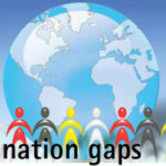
In this divided world, emerges an additional fault line
Vaccinated vs. un-vaccinated.
If in high-income countries around 60% have been vaccinated with at least one dose, the percentage remains abysmally low at around 3% in low-income countries.
The priority to vaccinate ones own first is understandable and justifiable to some extent,
But the concerns towards …
November 2021
Digital Construction Week
24-25, November London, UK
www.digitalconstructionweek.com
Navigation 2021
15-18 November
https://rin.org.uk
GEO Business
24-25 November London, UK
www.geobusinessshow.com
December 2021
SIRGAS2021 (virtual)
Nov 29 to Dec 1
www.sirgas.org/en/sirgassymposia/ symp_2021 www.geobusinessshow.com
February 2022
Geo Week
6-8 February, 2022 Denver, CO, USA
www.geo-week.com
DGI Geospatial Intelligence for National Security 2022
London on 08-09 February 2022
https://dgi.wbresearch.com
March 2022
Munich Satellite Navigation Summit 2022
7-9 March Munich, Germany
munich-satellitenavigation- summit.org
IGRSM 2022
8-9 March Virtual Conference Kuala Lumpur Malaysia
https://www.igrsm.org
Tweet
Collins Aerospace launches Military Underwater Navigation System
Collins Aerospace has launched the world’s first Military Underwater Navigation System with M-Code (MUNS-M), a handheld diver navigation system that provides the diver with precise position and includes secure anti-jamming capabilities during deep sea missions. M-CODE is the military GPS signal required by the U.S. DOD for military operations, …
Trial run of delivering vaccines by drones
The Telangana government in India holds a trial run of delivering medicines and vaccines using drones. It is a part of state government’s ambitious ‘Medicine From The Sky’ project. On the first two days, the drones will be flying in the visual line of sight – between 500 and …


 (5.00 out of 5)