Singapore pledges S$10 million to the ITU P2C Digital Coalition
Recognising the importance of ensuring that all countries are able to participate in and benefit from the growth of the global digital economy, Singapore is pledging S$10 million to the International Telecommunication Union (ITU) Partner2Connect (P2C) Digital Coalition …
People are able to perceive their surroundings in three dimensions and can quickly spot potential danger in everyday situations. Drones have to learn this. Prof. Dr. Stefan Leutenegger, principal investigator and leader of the innovation field artificial intelligence at the Munich Institute of Robotics and Machine Intelligence (MIRMI), refers to …

This study provided the police officers in the La- Dade Kotopon district Police headquarters with a user-friendly software for capturing crime data based on spatial location in real-time for hotspot maps, crime detection, classification, crime spatial dissemination and allocation of resources
Dennis Duffour
Geospatial Engineer at Daystar Geodata Consult Limited and Eagle Eye Survey Consult Limited, Ghana
Cosmas …

The apprehension that whether Delhi would withstand an earthquake of 7 magnitude similar to that occurred in Turkey this year needs to be pondered upon seriously
A K Jain
worked as Commissioner (Planning), Delhi Development Authority and as a member of the Committee of the Ministry of Housing and Urban Affairs on the DDA (2015). He was …

This article has identified and grouped 6 challenges the Surveying profession is grappled with in order to ensure its future and survival
Godwill Tamunobiekiri Pepple
Department of Surveying and Geomatics, Faculty of Environmental Sciences Rivers State University Port Harcourt, Nigeria
Emilia Biobele West
Department of Surveying and Geomatics, Faculty of Environmental Sciences Rivers …

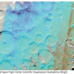
Study reveals map of moon’s water near its south pole
A new study using the now-retired Stratospheric Observatory for Infrared Astronomy (SOFIA) has pieced together the first detailed, wide-area map of water distribution on the Moon. SOFIA was a joint project of NASA and the German Space Agency at DLR. …

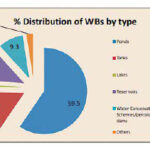
India’s first water bodies census released by Ministry of Jal Shakti
The Ministry of Jal Shakti has released the report of India’s first water bodies census, a comprehensive data base of ponds, tanks, lakes, and reservoirs in the country. The census was conducted in 2018-19, and enumerated more than 2.4 million water …

Volume XIX, Issue 5, May 2023
Development of GNSS software for Ghana Survey and Mapping Division
Gameti Charles, Acheampong Akwasi Afrifa, John Ayer
Energy transition in Nigeria: A technological and philosophical perspective
Mike Iroh
My Coordinates
EDITORIAL
His Coordinates
Jesse Huff
News
GIS | GNSS | IMAGING |
AUTONOMOUS DRIVING | INDUSTRY …

The concerns regarding Generative AI keeps widening –
From cheating on home assignments in education sector
To further proliferation of fake news, copyright issues, employment concerns and so on.
Open AI CEO Sam Altman in his representation before the US Congress
Reportedly emphasized on the importance of government intervention
In reducing the implications …


 (5.00 out of 5)