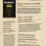
Coordinates starts a regular column on the accuracy assessment of satellite orbits and atomic clocks on board of all GNSS constellations (GPS, Galileo, Glonass, Beidou, QZSS and IRNSS)
Narayan Dhital
is actively involved to support international collaboration in GNSS-related activities. He has regularly supported and contributed to different workshops of the International Committee on GNSS (ICG), and …

Dr. Anthony Beck
An independent consultant who specialises in digital transformation using the Land Administration Domain Model (LADM), formerly with Registers of Scotland and Ordnance Survey International.
Vladimir V. Evtimov
the Food and Agriculture Organization (FAO), a land professional experienced in land reforms and land administration
Dr. Keith Clifford Bell
International Development Consultant for Land, Geospatial Information and Disaster Resilience …

The planning of intermediary cities needs to refocus on the emerging issues of sustainability, economy, energy and climate and disaster resilience
A K Jain
Worked as Commissioner (Planning), Delhi Development Authority and as a member of the Committee of the Ministry of Housing and Urban Affairs on the DDA (2015). He was a member of UN Habitat …

Volume XIX, Issue 12, December 2023
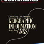
Collecting volunteered geographic information from the Global Navigation Satellite System
Linda See, Benedikt Soja, Grzegorz Klopotek, Tobias Sturn, Rudi Weinacker, Santosh Karanam, Ivelina Georgieva, Yuanxin Pan, Laura Crocetti, Markus Rothacher, Vicente Navarro, Steffen Fritz and Ian McCallum
A review of land information management systems
Ifeanyichukwu Valentine Nwafor, Raphael Oshiobugie Sado and Inipami …

The projected achievement of COP28, Dubai
Need to transition away from fossil fuels in energy system,
In a just, orderly and equitable manner,
Neither has any binding nor the timeline to adhere to.
Tripling the global target of the capacity of renewable energy,
Doubling the rate of energy efficiency improvements by 2030
Are the …
February 2024
Geo Week 2024
11 – 13 February
Denver, CO, USA
https://www.geo-week.com
MENA Geospatial Forum
14 – 15 February 2024
Dubai, UAE
https://menageospatialforum.com
March 2024
Geo Connect Asia
06 – 07 March 2024
Singapore
https://www.geoconnectasia.com
DGI 2024
11 – 13 March
…
RIEGL launches three airborne survey systems
RIEGL has released three airborne survey products, which are are designed to enhance sensor performances and capabilities in various segments, from terrestrial, to mobile and airborne applications.
The VQX-2 helicopter pod is designed for airborne data collection. It integrates a RIEGL laser …
NavIC L1 signal tracking now operational on JAVAD GNSS latest receivers
JAVAD GNSS announced that its latest receivers are successfully tracking the NavIC L1 signal broadcast from the first of its second-generation navigation satellites, launched May 29, 2023. As additional satellites with L1 frequency (1575.42 MHz) capability …
Geospatial AI to address climate change
IBM has released its latest geospatial artificial intelligence (AI) initiative to address climate change. These efforts involve collaborations across various regions and uses advanced AI models designed for geospatial applications.
Central to these initiatives is IBM’s geospatial foundation model, developed jointly with NASA. These models aim to generate environmental insights and …


 (5.00 out of 5)