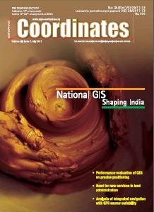
The Planning Commission, Government of India has floated the idea of the National GIS.
It has established an Interim Core Group (ICG) to prepare a blueprint for the development of the National GIS. With a vision to establish a national “GIS Platform” through an organizational structure of Indian National GIS Organization (INGO).

What has triggered the idea of National GIS?
The idea of National GIS (NGIS) has been driven by the needs of the Planning Commission, Government of India. The Planning Commission looks for lot of information which helps them in the process of planning. The need has been felt to integrate many of these information so that they can utilized effectively for various planning processes and applications.

Performance evaluation of the effect of QZS (Quasi-zenith Satellite) on precise positioning: Nobuaki Kubo, Tomoko Shirair, Tomoji Takasu, Akio Yasuda, Satoshi Kogure;
Need for new services in land administration: András Osskó;
Analysis of integrated navigation with GPS source variability:Mahmoud Efatmaneshnik, Yong Li, Allison Kealy, Andrew G Dempster

Guidance and steering control systems that are now in widespread use by farmers for ploughing and cultivating the land with unprecedented accuracy, require centimetre-level position as well as attitude information accurate to a few degrees. Additionally, position and attitude update rate of no less than 10Hz is required for successful guidance in agricultural environments. Guidance and steering control systems rely particularly on heading and roll measurements to steer the tractor on parallel straight lines or curves known as plough lines.

A S (quasi-zenith satellite), which was anticipated to be the original Japanese positioning satellite, was launched in September, 2010. As an augmentation system of GNSS, two MTSATs had already been put into orbit and their main purpose is to broadcast the correction data for wide-area DGPS. This has actually improved the accuracy of wide area DGPS as a result of reception of the correction data from MSAS (MTSAT Satellite-based Augmentation System). The QZS also enhances the ranging function and it already has signal characteristics for the GNSS that are expected in the near future.

There is a general consensus among the land administration professionals and different players of the economy in the developed countries and more and more in the developing world as well, that the Land Administration is one of the most important infrastructure for the economic growth and the implementation of sustainable development. This fact is proved by statistical data.

The idea of National GIS (NGIS) has been driven by the needs of the Planning Commission, Government of India. The Planning Commission looks for lot of information which helps them in the process of planning. The need has been felt to integrate many of these information so that they can utilized effectively for various planning processes and applications.
July 2011: Esa International Summer School on Navigation Satellite Systems 2011, 20 – 30 July, Berchtesgaden, Germany, Berchtesgaden, Germany, www.munich-satellie-navigation-summerschool.org
iMapWeather radio application: Weather Decision Technologies, Inc. has announced the full suite of Location-Based Service features on the iMapWeather Radio App. The app sends alerts only to a user in a geo-referenced polygon of dangerous weather, reducing false alarms and keeping alerts focused on exact areas of impact.


 (5.00 out of 5)