Brussels Celebratory Launch Events: The launch of the two operational Galileo IOV (In-Orbit Validation) satellites on 20 October is a first in the history of the European Union. It is a moment to celebrate this unique and ambitious European collaboration.
UniStrong holds 40 pc GIS market share in China: Beijing UniStrong Science & Technology Co. Ltd. holds approximately 40 percent GIS market share in China, according to a report by Orient Securities Company Ltd. In next five years, the company is poised to do the business of approximately 100 billion yuan (USD 15.6 billion), China Daily reported.
50th Space Wing gains control of newest GPS Satellite: The 50th Space Wing’s 2nd Space Operations Squadron accepted command and control of the second Global Positioning System Block IIF satellite. The Space and Missile Systems Center’s GPS Directorate, located at Los Angeles Air Force Base, remained in control of the satellite during a 30-day on-orbit checkout period before the hand-off to 2 SOPS. The next-generation GPS IIF satellites built by Boeing will provide improved accuracy through advanced atomic clocks, a longer design life than legacy GPS satellites, and a new third civil signal, L5 that will eventually benefit commercial aviation and safety-of-life applications
TRIUMPH-VS software updates version 1.6 is released: Javad has released Version 1.6 of TRIUMPH-VS software. Its new features include Polish language support and Action button debounce. It has also improved Map screen performance, Languages support, Point coordinates input, Fixed Base Station action, Solution RMSes display in Action screen, US Survey units (feet) support, Device temperature monitoring and UHF Setup.
France to begin investigation of Apple’s location-based tracking services: The issue over location-based tracking has been plaguing Apple for a while now. The Cupertino-based company along with Google were questioned by the government over privacy concerns with location-based tracking. A federal lawsuit was also filed against Apple several months ago and not too long ago Apple recently settled a similar lawsuit in South Korea by paying a $3,000 fine and an additional $1,000 to a South Korean user, who seemed to take an issue with the tracking. Given that the fine Apple had to pay in South Korea seems like a pittance, we’re guessing the legal fees will cost a lot more and it appears that Apple may have to start digging into their coffers again as France has started their own investigation.
1,145 satellites to be launched in next decade:
Euroconsult, a research and analyst firm specialising in the satellite and space sectors, forecasted that approximately 1,145 satellites will be built for launch during the next ten years (2011-2020), 51 percent more satellites than the previous decade. These projections came from Euroconsult’s just-released Satellites to be Built & Launched by 2020, World Market Survey.

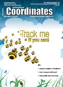
This paper is going to provide a concept of a new system for positioning the target bees. The biologists eagerly wish to collect the bodies of the bees in order to find the causes of the colony collapse disorder (CCD) of bees. As we know it, there are several ways used to find out and trace animals. For example, the scientists set up the transponders or the GPS trackers on the top of shells of thalassians or on the feet of migrant birds by ringing. These methods make great contributions for tracking and studying in the field of the biological research. However, how to track or position small insects, like cicadas, butterflies, or bees, is still a problem needed to be solved. The obvious crux of the problem is the size and the weight of the devices which are not suitable for fitting on such a small insects.

We come from a situation where the societal relevance of a cadastre was limited to the core statutory tasks of registration and maintenance of cadastral maps and providing information on land parcels and their ownership and use-rights (van der Molen, 2009). Nowadays, modern land registry organisations do not only face many new challenges, also the pace of demand for new products and services increases every year.


 (5.00 out of 5)