The latest Apple iPhone will be the first among cellphone manufacturers outside Russia to use both the global navigation satellite systems – American GPS and Russian GLONASS. Russia is working on promoting the use of the GLONASS, an in order to do so it is planning to levy heavy import duties in the country on the Phones not using GLONASS.
Since its certification for use in managing air traffic and other securitycritical applications in 2011, EGNOS – Europe’s augmentation system for GPS – now enables new applications for precise and reliable satellite navigation. To promote EGNOS, the European GNSS Agency (GSA) is offering a special prize for the most promising idea using the system.

Only 1.5bn of the estimated 6bn land parcels worldwide have land rights formally registered in land administration systems. Many of the 1.1bn slum dwellers and further billions living under social tenure systems wake up every morning to the threat of eviction. These people are the poor and most vulnerable and are excluded any form of security of tenure; they are trapped in poverty. Increasing global population and the rush to urbanisation is only going to turn this gap into a chasm.

Roads are improved and maintained depending on its roles such as transport routes, minelayers of lifelines, refugee roads at disaster and also needs of users. To improve the roads safety and convenience, road authorities need the data to be used to comprehend 3D shape of the road space and its deformation quickly and accurately.

WAAS provides very precise navigation service, with both horizontal and vertical guidance over the Continental United States (CONUS) and a large portion of Alaska, Canada, and Mexico. Other countries and regions of the world also have fielded or are fielding similar systems. WAAS and each of these other systems are known as a Satellite Based Augmentation System, or SBAS. As envisioned at its inception, WAAS today provides service from enroute through approach.

We have read this article with interest and appreciate the opportunity offered to us by the Coordinates’ Editor to debate the point of view presented there regarding the evolution of Geodesy in different parts of the world. We hope the arguments presented in the following paragraphs provide valuable information regarding the current situation of Geodesy in the Latin America and Caribbean regions.
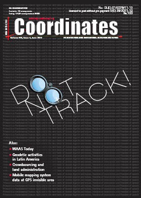
There is a saying that “it takes a thief to catch a thief”. This is because to know the modus operandi of a presumptive thief is to know when, where and how that person operates. What better way than to put a ‘tag’ that will follow every movement of that person to gather evidence in order to implicate that person. Hiding a global positioning system (GPS) on a person’s vehicle is one means of collecting information with a view to later prosecution of the driver of the vehicle where a criminal act is committed.
July 2012:
COM.Geo 2012, 1-3 July,
Washington DC, USA, www.com-geo.org/conferences/2012/index.htm
2012 Brisbane International Geospatial Forum, 8 – 11 July
Queensland, Brisbane, Australia, www.imtamaps.org/events/


 (5.00 out of 5)