Valuation of real estate/ properties is in many countries/ cities the basis for fair taxation. The property value depends on many aspects, including the physical real world aspects (geometries, material of object as build) and legal/ virtual aspects (rights, restrictions, responsibilities, zoning/development plans applicable to the objects spaces). The aim of this study is to investigate the opportunities provided by the semantically rich 3D building and cadastral models for valuation and taxation. In this paper we investigate the following related aspects…

The provision of public services is considered as one of the basic goals which city managements all over the world seek to realize. In particular, the provision of public services indicator is considered as one of the most important urban indicators which reflect the quality of life for city residents. In this regard, the High Commission for the Development of Arriyadh, that is responsible for planning and comprehensive development of the city, has approved an overall plan for coordination and provision of public services in Arriyadh city.

The most basic operation of a vessel monitoring system is to determine the location of the vessel at a given time, and periodically send this information, usually by satellite, to a monitoring station ashore. Most of vessels are tracked using the purple finder. This finder uses various satellites like Inmarsat, Globalstar and Thuraya for tracking the vessel. INMARSAT-C has been the most considered choice, since INMARSAT transceiver is already fitted onboard many ocean-going vessels as required by GMDSS (Global Maritime Distress and safety System).

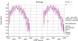
Over the recent past, the vulnerability of Global Navigation Satellite Systems (GNSS) to interference has become a concerning issue (Mitch, 2011), (Pullen, 2012). Nowadays, illegal portable jamming devices are becoming popular to protect the user from being tracked by GNSS in their vehicle. These so-called personal privacy devices radiate different types of interference signals in the GNSS frequency bands and can make conventional receivers inoperable. Counter measures have to be taken to prevent strong interference from blocking the GNSS-receivers for safety critical applications.
RCD30 Penta Oblique system is now available with new optics. The camera is now available with 80 mm and 150 mm focal length respectively…


 (5.00 out of 5)