

The Galileo satellite constellation has begun providing positioning, navigation and timing information for shipping, offshore and search and rescue operations…

No, not at all. It has been very much a live entity devoted to facilitating provision of discovery and access to spatial data sets captured by different partnering agencies of National Spatial Data Infrastructure (NSDI)…
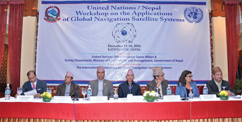
The United Nations/Nepal Workshop on the applications of global navigation satellite systems (GNSS) was organized jointly by the United Nations…

Monitoring is the fastest growing discipline in the survey market. Surveyors undertake the difficult task to answer…

Bentley advances infrastructure by delivering solutions for the entire lifecycle of the infrastructure asset, tailored to the needs of the various professions – engineers, architects, planners, contractors, fabricators, IT managers, operators, and maintenance engineers – who will work on and work with that asset over its lifetime…

Situated above the Arctic circle, the Northern Part of Finland called Lapland, is known for its unique knowhow in technologies dealing with snow, ice and cold. This is not suprising taken into account that winter lasts here for more than 6 months and snow tchikness rises up to 1 metre.

GNSS-based localization is no more or less secure today than it was a decade ago. From a technical standpoint, GNSS has always been vulnerable, and the equipment required to compromise it has long been accessible to everyone…


 (5.00 out of 5)