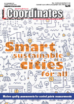
After three incredibly successful days in Berlin, INTERGEO 2017 has drawn to a close. The trade fair and conference have been carried on the crest of the unstoppable wave that is digitalisation. Displaying a truly impressive spirit of…

Penggaron bridge is located in Semarang-Ungaran toll road, 20th kilometer in Susukan region, East Ungaran, Semarang. According to PT. Transmarga Central Java, The bridge is relatively new and actively used since 2010, but the bridge is visually deformed as indicated by small cracks in some pillars of the bridge.

Volume XIII, Issue 10, October 2017
Zip
Smart sustainable cities for all: A socio-spatial approach
Maryam Rabiee, Abbas Rajabifard
The potential use of VGI for 3D cadastre surveys
Maria GKELI, Charalabos IOANNIDIS, Chryssy POTSIOU
Low cost GNSS and Geo-referencing
Tomoye Allen,Ronaldo Brown, Amahl Hutchinson, Keith Wignall, Glendon G. Newsome
Development of inverse pedagogy through the implementation of a …

Facts and fictions
The booming fake content industry
Might be serving the immediate interests of the some
But will have long-term consequences,
Not only in terms of increasing distrust
For print and digital media – both
But also may have indelible marks
On unsuspecting minds.
The phenomenon will not be confined
To only political, social and …
October 2017
Commercial UAV EXPO
24 – 26 October Las Vegas,USA
www.expouav.com
6th International Colloquium — Scientific and Fundamental Aspects of GNSS/Galileo
25 – 27 October Valencia, Spain
http://esaconferencebureau.com/2017-events/17a08/introduction
3D Australia Conference 2017
26 – 27 October Melbourne, Australia
http://3dgeoinfo2017.com
ITS World Congress 2017
29 October – 2 November 2 Palais des congrès de Montréal, Quebec
itsworldcongress2017.org
November 2017
37th INCA INTERNATIONAL CONGRESS
1 – 3 November Dehradun, India
http://incaindia.org/index.php/2016/12/10/37th-incainternational-conference-2017/
The 7th …


 (5.00 out of 5)