
Fifth launch brings AireonSM Global Air Traffic Surveillance System
Aireon has announced the fifth successful launch and deployment of its space-based Automatic Dependent Surveillance- Broadcast (ADS-B) payloads, hosted by the Iridium® NEXT satellite constellation. When the Aireon payloads from the fifth launch come online, the system will have nearly global coverage with 15-minute or better …
Discover more with new Ordnance Survey GPS Devices
Ordnance Survey (OS) has announced the launch of four new off-road OS GPS navigation devices for walking, hiking and off-road cycling. The innovative GPS units are a first for OS, and have been designed for ease-ofuse straight out of the box. They boast the trusted accuracy that …
BCF support and GIS integration added to new 3D Repo version
3D Repo has released a new version of its cloud-based BIM platform that allows users to simultaneously access, via the web, the latest 3D construction models, detect changes, collaborate on them and make informed decisions. The latest version of 3D Repo includes support for …
senseFly’s eMotion 3.5
senseFly has released eMotion 3.5, which includes a raft of new features and functionality, all designed to make the working lives, and workflows, of geospatial professionals simpler and more efficient.
eMotion 3.5 has added Beta-level language support for Simplified Chinese and Spanish,Agisoft PhotoScan integration, Smart mission resume and Live air traffic data. …
KYMCO launches Noodoe Navigation
KYMCO has launched Noodoe Navigation, a revolutionary navigation experience designed from the ground up for riders. It pioneers a ROADFOCUSED NAVIGATION concept.
It is a completely new rider-centric approach in the navigation industry. Instead of continuously telling riders how many meters until the next turnand requiring them to stare at the …
Airborne to manufacture solar array panels for Galileo satellites
Airborne Aerospace has announced on March 22 it has been awarded a contract by Airbus Defence and Space Netherlands (Airbus DS NL, Ottobrunn, Germany) to manufacture 48 substrate panels, which consist of highperformance carbon composite materials, for the solar arrays of 12 new Galileo FOC satellites. …
India and France agree to enhance cooperation in space technology
India and France issued a Joint Vision for Space Cooperation, during the recent visit of French President, Mr Emmanuel Macron, to India.
The vision lists specific areas for future cooperation between the Indian and French space agencies, ISRO (Indian Space Research Organistion) and CNES (Centre …
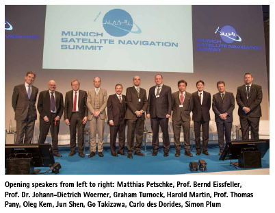
GNSS will play a key role for autonomous systems in the future – whether it is on the road, in the air or at sea.
The renowned conference “Munich Satellite Navigation Summit” was held on March 5 – 7, 2018, again organized by the Institute of Space Technology and Space Applications (ISTA) of the Bundeswehr University …

Despite the technology being employed in countries around the world, including the United States, Europe, China, Russia, India and Japan, a SBAS has not been previously used or tested in Australia…

FIG was founded on July 18 1878 in Paris by delegates from seven national associations – Belgium, France, Germany, Great Britain, Italy, Spain and Switzerland. Today FIG has been recognized by the United Nations and the World Bank…


 (5.00 out of 5)