Pause and re-plan!
A recent study
‘Satellite-derived Time and Position: A Study of Critical Dependencies’
by The UK Government Office for Science
Reviews the UK’s dependency on GNSS
And recommends measures to improve resilience
Including by adopting potential back-up systems.
More than the findings,
The worth appreciating is the approach.
The approach of ‘a pause’
Where …

Volume XIV, Issue 2, February 2018
Zip
Technology trends: From GPS to multi-constellation GNSS
Guy Buesnel
Academic drift and surveying education
Dr Garfield Young
Assessment of accuracy of basic maneuvers performed by an UAV during autonomous flight
Pawel CWIAKALA
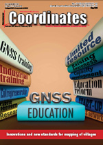
Innovations and new standards for mapping of villages in Indonesia
Fahmi Amhar, Bambang Riadi, Fachrul Hidayat, Tia Rizka Nuzula Rachma
GNSS education: Prospects and challenges
Mia Filic´and …

Car to caravan
Another feat of mankind.
Falcon Heavy by Sapce X symbolizes
The dreams and the dreamers.
Imagination, inventiveness and ingenuity.
A journey from surrealism to reality.
It was not Falcon Heavy alone,
Along with it was Tesla Roadster.
A craft, along with a car.
Will it eventually be followed by a caravan?
Who knows!
Bal …
March 2018
Munich Satellite Navigation Summit
5 – 7 March Munich Germany
http://www.munich-satellitenavigation-summit.org
EUROGEO 2018
15 – 17 March
Cologne, Germany
http://www.eurogeography.eu
Gi4DM 2018
18 – 21 March
Istanbul Technical University, Turkey
http://www.eurogeography.eu
United Nations/Argentina Workshop on the applications of GNSS
19 – 23 March
Falda Del Carmen, Argentina
http://www.eurogeography.eu
April 2018
The 7th …
Belgocontrol to assist drone users
Belgocontrol and the Belgian Civil Aviation Authority (BCAA), together with the company Unifly, are developing two digital platforms to assist both recreational and professional drone users in their activities. All applications will be operational by the end of this year.
A first application will result in a website for the …
Astrata launches VanLinc
After more than 25 years developing high-end telematics software for the HGV industry globally, Astrata is now bringing its expertise to benefit the European LCV market with the launch of VanLinc™.
This fleet management solution provides real-time insights on drivers, vehicles and other assets, helping businesses drive productivity and increase capacity for …
2G ULS-500 PRO System delivered to Kongsberg
2G Robotics has announced the first of four ULS-500 PRO laser scanning systems has been shipped to Kongsberg Maritime for integration into the Norwegian Defence Materiel Agency’s (NDMA) newly purchased HUGIN AUV’s. The acquisition signifies the Royal Norwegian Navy’s transition to autonomous systems for mine countermeasures. During operations, …
Iridium announces date for fifth Iridium® NEXT Launch
Iridium Communications Inc. announced that the fifth Iridium NEXT launch has been targeted by SpaceX for March 18, 2018. The first of four launches planned for 2018, Iridium-5 will deliver 10 more Iridium NEXT satellites to orbit, bringing the total number of new satellites deployed to 50.
…
China teams up with U.S. firms to build aviation navigation database
China’s top aviation regulator partnered with U.S. companies to develop the country’s aviation navigation database.
The air traffic management bureau with the Civil Aviation Administration of China inked a cooperation agreement with U.S. aviation solutions provider Jeppesen and industrial giant Honeywell to make a …
Large-scale solar parks in Madhya Pradesh, India
Indian Renewable Energy Development Agency Limited (IREDA) and Rewa Ultra Mega Solar Limited (RUMSL) signed an agreement for financing the shared infrastructure of two large Solar Parks in Madhya Pradesh on 31st January 2018. Ministry of New & Renewable Energy (MNRE), World Bank & IREDA have been able …


 (5.00 out of 5)