

In Sub-Saharan Africa, and also in many developing regions, there are numerous activities for land tenure recording; however, the results are deviating from the experts’ expectations…

Geological data show that the region of Central-west Bulgaria is characterized by the presence of active deformations and modern seismic activity. The southern region of Sofia shows a complex tectonics formed by the intersection of several active faults.

3D modeling of cities has become very important as these models are being used in different studies including energy management, visibility analysis, 3D cadastre, urban planning, change detection, disaster management, etc…

Due to rapidly increasing applications of GNSS dependent systems, motivation has increased to spoof these signals for illegal or concealed transportation and to mislead receiver timing used by critical infrastructure. Detection and mitigation of spoofing…

Volume XIV, Issue 10, October 2018
Zip
High positioning accuracy and precise time transfer with PPP GNSS receivers
Dr. ing. Marco Lisi
A vision for a fully digital cadastral survey system
Anselm Haanen, Trent Gulliver
A Large-scale Monitoring System of Tree Tilt Angle through Integrating Smart Sensing Technology and GIS
Dr Man Sing WONG, Dr Billy C.H. HAU, Ka Wai HUI Karena, Dr …
UAV policy impetus
Finally, one can fly drones in India
Legally after December 1, 2018
After taking permission
And observing certain regulatory provisions,
As per the policy regulations
From the Office of Director General of Civil Aviation
Released in the last week of August.
UAVs get a push from the top echelon of the government
Which …
November 2018
Trimble Dimensions 2018
05 – 07 November
Las Vegas, USA
www.trimbledimensions.com
CHINTERGEO2018
7 – 9 November Chengdu, Sichuan Province PR China
www.chintergeo.com
International Navigation Conference 2018 Bristol, UK
12 – 15 November
http://www.rin.org.uk/Events/5185/International-Navigation-Conference-2018
ITSNT 2018
13 – 16 November
Toulouse, France
http://www.itsnt.fr
Commercial UAV Show
14 – 15 November 2018 London, UK
www.terrapinn.com/exhibition/the-commercial-uav-show/
United Nations World Geospatial Information Congress
19 – 21 November Deqing, …
New version of labsat satgen V3 of GNSS simulation software
An updated version of SatGen v3 is now available to download. Along with a number of optimisations and fixes, this is a major update to the capabilities of the software as it now allows for the simulation of new satellite signals such as L2, L2C, …
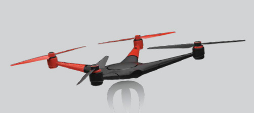
senseFly launches eBee X Drone
senseFly has launched the eBee X. The eBee X, part of the Parrot Business Solutions portfolio, is designed to boost the quality, efficiency and safety of an operator’s geospatial data collection. It offers a camera to suit every job, the accuracy and coverage capabilities to meet the requirements of even …
Driving geospatial innovation in Singapore and the UK
Managing Director of Ordnance Survey (OS) International, Peter Hedlund, and Singapore Land Authority (SLA) Director of Geospatial and Data, Mr Ng Siau Yong signed an MOU which will see both organisations intensify focus on the promotion and use of geospatial information to support smart services and solutions …


 (5.00 out of 5)