
FCC approves use of Galileo GNSS in the US
The FCC has granted in part the European Commission’s request for a waiver of Commission rules so that nonfederal devices in the US may access specific signals transmitted from the Galileo. While private users were free to use the European GNSS, with this ruling entity such as …
£1.5 million geospatial competition open to improve public services
The Geospatial Commission has partnered with Innovate UK to launch a new government competition, where organisations can apply for a share of £1.5 million to fund projects which use data linked to a location. Between £50,000 to £750,000 could be granted to eligible organisations.
The aim of the …
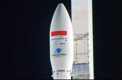
New China-Brazil Earth resources satellite in launch in H2 2019
The China-Brazil Earth Resource Satellite- 4A (CBERS-4A) will be launched in the second half of 2019, according to Li Guoping, secretary-general of the China National Space Administration (CNSA).
With a spatial resolution of two metres, the CBERS-4A satellite will offer the highest precision among CBERS satellites, though …

We can treat Agricultural Land Consolidation as a merging, enlargement, eliminating of mosaic land ownership and improvement…

In light of the emergence of big data, I have advocated and argued for a paradigm shift from Tobler’s law to scaling law, from Euclidean geometry to fractal geometry…

This study explores the existing CORS network particularly the Greater Accra CORS to know the extent of its usage for GPS surveys in Ghana and to determine its usefulness in ensuring uniform and homogenous data collection
Surv. Sebastian Botsyo (MGhIS)
Ghana School of Surveying and Mapping, Cantonments, Accra, Ghana
Bernard BORKETEY BORTEI
Geomatic Engineer, Volta River Authority, Ghana
John AYER
Senior …

The emblematic intergovernmental Group of Earth Observations (GEO) sees food, water and energy security, natural hazards, pandemics of infectious diseases, sustainability of key services, poverty,…

A digital ledger is a geographically distributed database that is shared and synchronized across a network by consensus of the network participants…

Let’s map together!
Mapping millions of land rights
That remains unrecorded in East Africa
Poses major challenge.
Its4land, a European Commission Horizon 2020 project
Aims to develop tools
With a multi-disciplinary approach in diverse cultural set-ups
Utilizing latest technologies
Like smart sketch maps, UAVs, automated feature extraction
Those are innovative, scalable and transferable.
However, the key …


 (5.00 out of 5)