

YOUR BEST OPPORTUNITY TO CONNECT WITH THE INTERNATIONAL DEFENCE AND SECURITY
GEOSPATIAL INTELLIGENCE COMMUNITY
As allied nations increase investment in military space and geospatial intelligence, DGI remains the
trusted global forum for senior military leaders, industry and academia to shape the future of multi-
domain ISR.
Find out how to navigate this evolving landscape by joining the World’s leading geospatial
intelligence …
German Orbital Systems to deploy Neuraspace STM
CubeSat manufacturer German Orbital Systems has contracted Neuraspace to secure the 16U pilot satellite, Pathfinder A, of ESA’s upcoming Celeste In-Orbit Demonstration constellation for LEO PNT (Low Earth Orbit Positioning, Navigation and Timing) with space traffic management (STM) capabilities. …
India elected co-chair of UN-GGIM-AP
India has been elected as the Co-Chair of the Regional Committee of United Nations Global Geospatial Information Management for Asia and the Pacific (UN-GGIM-AP). It was represented in the election by Hitesh Kumar S. Makwana, IAS, Surveyor General of India.
The elections took place during the 14th Plenary Meeting of UN-GGIM-AP, held …
International aid was meant to heal broken economies and build fairer societies. Yet decades and billions later, the results remain uneven, often entangled in politics, flawed incentives, and misplaced priorities. In this wide-ranging conversation with Coordinates, development economist Dr. Emily Brearley speaks about the moral contradictions of aid, the misplaced faith in technology, and what …

The analysis performed in this report is solely his work and own opinion. State Program: U.S.A (G); EU (E); China (C) “Only MEO- SECM satellites”; Russia (R); Japan (J); India (I)
Narayan Dhital
Actively involved to support international collaboration in GNSS related activities. He has regularly supported and contributed to different workshops of the International Committee on …

This article describes how cadastral surveying and mapping have developed in Norway, the background to the introduction of an authorization system, how the new authorization system will be organized, and the status of issuing surveyor’s certificates.
Leiv Bjarte Mjøs
Dr. Philos., Professor, Department of Civil Engineering and Environmental Sciences, Western Norway University of Applied Sciences
Abstract
After January 1, …

The research contributes to the optimization of cadastral processes and highlights the importance of selecting appropriate GNSS techniques based on factors such as distance to CORS and traceability requirements.
Assoc. Prof. Sr. Dr Tajul Ariffin Musa
Faculty of Built Environment and Surveying, Universiti Teknologi Malaysia, 81310 Johor Bahru, Johor, Malaysia
Nur Alyya Nordin
Faculty of Built Environment and Surveying, …

Geo Connect Asia 2026, themed “Geospatial driven impacts: underground, land & sea to sky”, focuses on bringing the geospatial and location intelligence industries together for two days of face-to-face discussions and networking on the 31st March & 1st April in Sands Expo & Convention Centre, Singapore.
Supported by the Singapore Land Authority, the event and conference …
Volume 21, Issue 10, October 2025
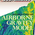
Australia’s first state-wide airborne gravity model
Volker Janssen, Thomas Grinter and Maria Jansen
…


 (5.00 out of 5)