September 2011:
Geospatial Defence & Intellegence Asia Pacific, 20 – 23 September, Kuala Lumpur, Malaysia
www.geospatialdefenceasia.com

We come from a situation where the societal relevance of a cadastre was limited to the core statutory tasks of registration and maintenance of cadastral maps and providing information on land parcels and their ownership and use-rights (van der Molen, 2009). Nowadays, modern land registry organisations do not only face many new challenges, also the pace of demand for new products and services increases every year.

Paul van der Molen
In the book ‘Congo’ (2010), the author David van Reijbrouck reports about the roundtable conference in Brussels in January 1960. There, the Belgian and Congolese delegation agreed on independence of the Congo already in June of that year. From an institutional side, hardly anything was in place in the -soon ‘former’- colony. Executive staff was panicking: ‘how to get a popular census in place in six months, a number plate administration, a cadastre…’.
May 2011: FIG Working Week 2011, 18 – 22 May, Marrakech, Morocco, www.fig.net;
5th GNSS Vulnerabilities and Solutions Conference, 23 – 25 May, Baska, Krk Island, Croatia, http://www.rin.org.uk/;
Geo Week
February 13-15, 2023
Denver, USA
DGI 2023 – Geospatial Intelligence for National Security
27 Feb to 01 March
London, United Kingdom
Geo Connect Asia
15-16 March 2023
Singapore
Drones Asia
15-16 March 2023 Singapore
Digital Twins 2023 (Virtual)
23 March 2023
GEO Business 2023
17-18 May
London, UK
RIN Baska GNSS Conference (& Smart Maritime Workshop)
14-19 May 2023 Baska, Croatia
9th International Conference on Geomatics and Geospatial …

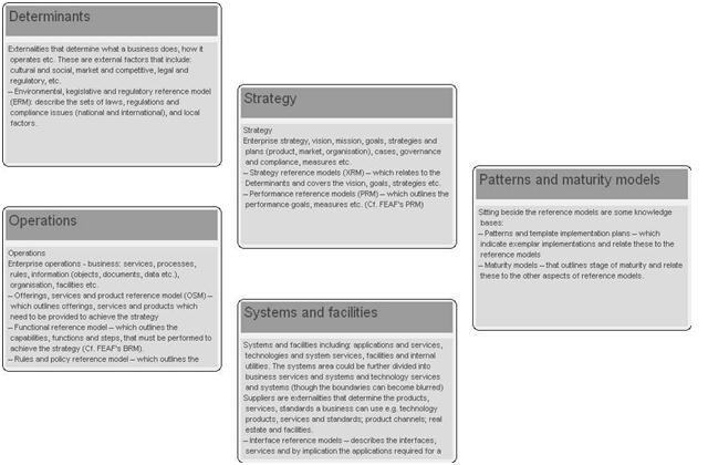
Best practice implementations needs to reflect experience: with cost effective world leading operational national systems; several generations of change i.e. experience with different models of private sector and public sector collaboration; in creating and extending systems of policy, regulation and governance; of the affects of different governance regimes, cultures and from international programmes. They therefore need to cover:


 (5.00 out of 5)