Articles in the News Archives Category

Non-GPS Navigation for GPS denied environments
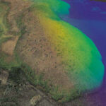
Scientific Systems has announced that it is continuing development of ImageNav™, the company’s non-GPS, image-based, precision navigation software. The company has recently extended and demonstrated its image based solution during flight operations ranging from 25,000 feet down to 200 feet.
For many …
DroneAcharya to train Adani Group in DGCA certified drone operations
DroneAcharya Aerial Innovations, a listed drone startup secured a significant service order from the Adani Group. This involves providing certified drone pilot training for DGCA (Directorate General of Civil Aviation). financialexpress.com
Inertial Labs and E38 Company partnership …
Omnispace tests LEO tech with Africa’s biggest telco
Omnispace is testing its plan to use 600 low Earth orbit (LEO) satellites to deliver connectivity directly to smartphones and other devices in Africa. They will be partnering with MTN, the largest mobile network operator in Africa, to conduct these …
Arabsat and Aldoria collaborate on space safety
Arabsat and Aldoria have announced the signing of a MoU to collaborate on enhancing space safety and security. This MoU sets the stage for expanded collaboration on key strategic initiatives and potential ventures. Under this agreement, Aldoria would provide its advanced space solution to Arabsat and its member countries, …
EGNOS Safety of Life Assisted Service for Maritime Users
EGNOS, Europe’s regional satellite-based augmentation system (SBAS), is adding a new service to its repertoire: The EGNOS Safety of Life Assisted Service for Maritime Users (ESMAS).
DGNSS, short for Differential Global Navigation Satellite System, is an enhancement to GNSS that …
Dharavi redevelopment to kickstart with survey
The Dharavi Redevelopment Project Pvt Ltd (DRPPL), a joint venture between the government of Maharashtra and the Adani Group, recently announced that a survey would be launched to collect data from the lakhs of slum dwellers living in Dharavi. The data will …
ACL Digital partners PhoenixAI. tech for AI drone solutions
ACL Digital has forged a partnership with PhoenixAI.tech to propell the future of AI-powered drones. The partnership will leverage PhoenixAI.tech’s and ACL Digital’s pioneering work in developing advanced AI/ML algorithms for uncrewed vehicles, IoT, and C-V2X. Together, the companies …
Trimble introduces MX90 Mobile Mapping System
Trimble released the Trimble MX90 mobile mapping system. It provides a complete field-to-finish mobile mapping solution that enables powerful workflows for data capture, processing and analysis. The vehicle- or train-mounted MX90 rapidly captures highly detailed laser scans and imagery—both panoramic and …
Funds for space preservation efforts by UK Space Agency
The UK Space Agency recently allocated a £2m investment for research into the refuelling of a mission designated for the removal of space debris. Currently, numerous inactive space objects orbit Earth. Statistics indicate almost 37,000 objects larger than 10cm, …
Call for Proposals operationally ready CPNT Services
The Volpe National Transportation Systems Center of the U.S. Department of Transportation (DOT) has issued a solicitation to obtain proposals from vendors with operationally ready complementary positioning, navigation and timing (CPNT) services to be used for testing and evaluation in …


 (5.00 out of 5)