| Imaging | |
IMAGING
Arabsat and Aldoria collaborate on space safety
Arabsat and Aldoria have announced the signing of a MoU to collaborate on enhancing space safety and security. This MoU sets the stage for expanded collaboration on key strategic initiatives and potential ventures. Under this agreement, Aldoria would provide its advanced space solution to Arabsat and its member countries, enhancing their capabilities in safeguarding space assets. Furthermore, the partnership includes plans for the establishment of one of Aldoria’s sensor systems in an Arabsat member country, further strengthening space security measures in the region. www.arabsat.com
StriX-3 reaches its target orbit
Synspective announced that StriX-3, its fourth SAR satellite, has successfully reached its target orbit and spread its wings. It was successfully deployed into a Sun-Synchronous Orbit (SSO) at an altitude of 561 km by Rocket Lab’s Electron rocket from the Rocket Lab Launch Complex 1 on New Zealand’s Mahia Peninsula.
StriX-3 is not a newly developed and designed satellite but was manufactured based on the same conceptual design as StriX-1. To successfully build the desired satellite constellation, parallel production, or the capability to concurrently produce several satellites, is necessary. synspective.com
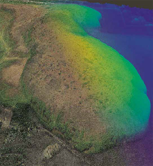
Eyeonic Vision System Mini
SiLC Technologies, Inc. (SiLC) launched the Eyeonic™ Vision System Mini (Eyeonic Mini), a groundbreaking advancement in LiDAR technology. This innovative system, integrating a full multi-channel FMCW LiDAR on a single silicon photonics chip and an integrated FMCW LiDAR System on-Chip (SoC), sets a new industry benchmark in precision. www.silc.com
Researchers develop method to measure carbon stored in bogs
Researchers at Singapore-MIT Alliance for Research and Technology (SMART), MIT’s research enterprise in Singapore, and Nanyang Technological University, Singapore (NTU Singapore), have developed a method that can accurately measure the amount of carbon stored in bogs. It uses satellite data and reduces the need for on-site sampling to derive the three-dimensional shapes of raised peatlands, also known as bogs, and hence the amount of carbon it contains.
The new mathematical model replaces earlier models whose accuracy is limited to specific bog conditions and was developed with collaborators from the Massachusetts Institute of Technology, University of Potsdam, Stanford University and the University of Minnesota.
Measuring carbon stocks in raised peatlands is challenging. The variable shape of bogs and varying depths of their carbon-rich soil known as peat, combined with their inaccessibility and vast size in many tropical regions, makes obtaining accurate data difficult, say the team of researchers. https://smart.mit.edu
INSAT-3DS begins imaging the Earth
INSAT-3DS, the meteorological satellite, has initiated Earth imaging operations. The first set of images by the meteorological payloads (6-channel Imager and 19-channel Sounder) was captured on March 7, 2024.
The satellite was launched on February 17, 2024. After completing orbit- raising operations, the satellite reached the designated geostationary slot for the In Orbit Testing (IOT) on February 28, 2024. As part of Meteorological Payload IOT, the first session of imaging for Imager and Sounder payloads was carried out on March 7, 2024. The payload parameters are found to be nominal, complying with payload specifications. Thus, all the payloads of INSAT-3DS have been tested to perform nominally.
Imager and Sounder payloads onboard 3DS are similar to the payloads flown on 3D and 3DR. Significant improvements have been achieved in radiometric accuracy, black body calibration, thermal management, and imaging throughput, among others. The payloads are designed and developed at the Space Applications Centre (SAC), Ahmedabad. The first images are processed and released at the Master Control Facility, Hasan.
The 6-channel imager equipment captures images of the Earth’s surface and atmosphere across multiple spectral channels or wavelengths. The use of multiple channels allows for gathering information about various atmospheric and surface phenomena, such as clouds, aerosols, land surface temperature, vegetation health, and water vapour distribution.
The imager could be configured to capture specific features of interest. The 19-channel sounder captures radiation emitted by the Earth’s atmosphere through channels carefully chosen to capture radiation emitted by different atmospheric constituents and properties like water vapour, ozone, carbon dioxide, and other gases, while others may be designed to measure temperature variations in different layers of the atmosphere.
These Payloads generate over 40 geophysical data products such as Sea Surface Temperature, Rainfall (precipitation) Products, Land Surface Temperature, Fog Intensity, Outgoing Longwave Radiation, Atmospheric Motion Vectors, High-Resolution Winds, Upper Tropospheric Humidity, Cloud Properties, Smoke, Fire, Mean Surface Pressure, Temperature Profiles, Water Vapor Profiles, Surface Skin Temperature, Total Ozone, etc., for the user community. The data collected derive information about the vertical structure of the atmosphere, crucial for weather forecasting, climate monitoring,and understanding atmospheric processes.
https://www.isro.gov.inx


 (No Ratings Yet)


Leave your response!