| Mycoordinates | |
GPS based control points for mapping
|
||||
|
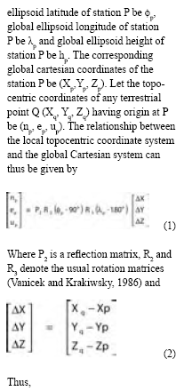
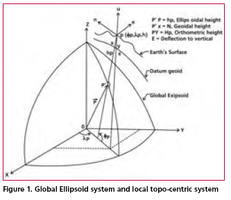
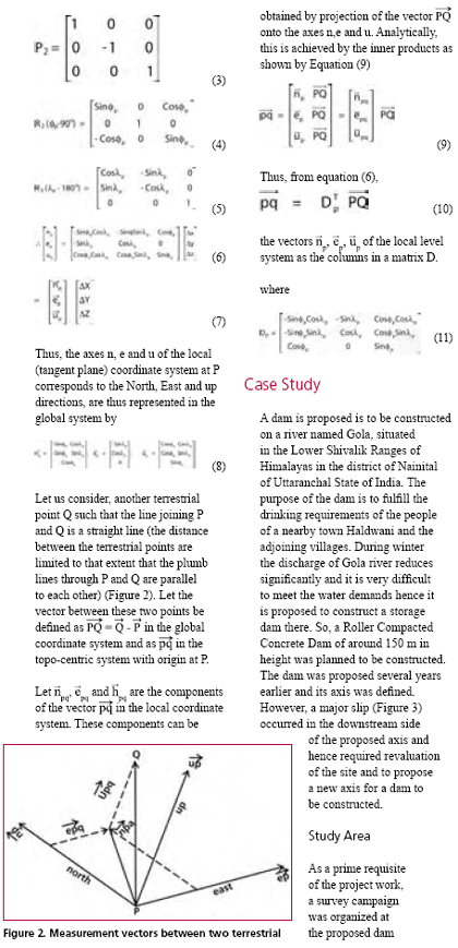
To carry out the infrastructural development in any area, topographical maps (accurate, reliable and updated) of that area are of vital important. Topographic maps are also important aids for administrative and strategic planning, disaster mitigation, socioeconomic development and other related activities. In order to prepare topographic map, it is prerequisite to have grid coordinates as well as elevations of control points. GPS has already been used as an important tool for establishment of control points accurately, quickly and economically in a versatile way. Though it provides precise planimetric position of a station but it provides gross imprecision in height (Ghosh and Rao, 2001). Moreover, the coordinates of the points are obtained in the WGS 84 reference system, a global coordinate system. But, for preparation of topographic maps, cartographers are in need of grid coordinates in local (topocentric) coordinate system. To find the local coordinates from global coordinates, transformation parameters between the local and the global system are required which requires at least known three common stations. But, due to security reason, often the precise local geodetic coordinates of control points are not made available to civil users. The problem of non-availability of local geodetic coordinates can be circumvent by adopting an appropriate method. The objective of this paper is to discuss a simple method for finding out the grid coordinates as well as elevation of control points in a topocentric coordinate system using GPS data followed by a case study implementing the method. MethodologyTo prepare a topographic map, it is a usually convenient to have grid coordinates in a topocentric coordinate system having geographic North, East and Vertical up directions as the three reference axes. In this section, Let the spatial orientation of the local coordinate system with origin at P is specified by the global geodetic coordinates site on River Gola. It was proposed to carry out a topographic surveying and mapping of an area of about 800 meter long and 300 to 400 meter wide in the bed of Gola river. Since the duration of surveying work was limited, it was planned that area to be surveyed is divided into parcel of land across the river having over lapping in each side. It was decided that each area would be provided with control points. To obtain accurate, quickly as well as easily, control points were planned to be established through GPS. Thus, coordinates of the terrestrial points are thus obtained are in a global system. But to prepare of topographic maps, topocentric coordinates of the control points are required. The requirement was met by transformation of global coordinates into topocentric local coordinates as discussed in previous section. |
||||
Pages: 1 2


 (No Ratings Yet)


