| LBS | |
GPS applications on cellular phone with geoid addition to height
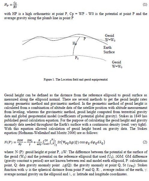
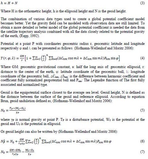
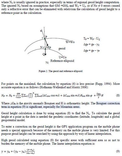
Location Base Services (LBS) is service mechanisms that provides information about the location and take advantage of the location. Global Positioning System (GPS) is one of Devices that inform the position. Mobile phone GPS has the advantage because they can be used also as a means of communication and the completeness of the camera (photo and video) resolution good enough to take photos that have coordinates ((Geo)tagging photo) and can be sent directly to the office for more information . GPS has higher accuracy than cell phones. Accuracy of GPS ranges from 5 to 30 meters, whereas for cellular phone a level of accuracy varies from 500 meters to 20 meters. The Information of position using a mobile can be used if it does not require a high degree of accuracy. For programming in the manufacture of software that runs on mobile phones in this study used the Java Micro Edition (J2ME) which can produce a good application and flexible and can be run on other mobile devices like mobile phones, personal digital assistants (PDAs), and printers. Java ME includes flexible use interface, powerful security, network protocols contained in devices, and support for network applications can be downloaded dynamically. Java ME-based application can be used in many devices, and increase the original capacity of each device. For the purposes of use in location-based programming in Java Specification Request provided J2ME (JSR) 179 JSR 179Java Specification Request (JSR) 179 has been created by the Java Community Process (JCP) to support location-based programming that has been connected in the Connected Limited Device Configuration (CLDC). Implementation of JSR 179 can be done in several positioning methods such as (Qusay, H. Mahmoud, 2004): • Using a cellular phone network. Cell ID can be used to identify the Base Transceiver Station (BTS). A mobile phone has the accuracy of 2 to 20 kilometer radius. Another technique may have the accuracy of 150 meters. • Using satellite. GPS is one of the techniques used this technology. In order to use this method the user must use a GPS receiver. Accuracy of this method to reach 4 to 40 meters. • Using short-range position beacons. This method is used for areas that are not too large. This method may use Bluetooth technology. API Location (JSR 179) in J2ME has optional package javax.microedition.location that has the ability to generate information on the position of equipment. Location API produces physical location information that can be used for landmarks that can be saved. • A Coordinate object shows a point latitude and longitude in degrees, and altitude in meters. • A Qualified Coordinates object contains latitude, longitude and altitude and also shows the level of accuracy is represented in the area radius. API Location J2ME provides a source of location information. Because there is security for accessing this method is provided SecurityException if there was no information to the desired position HighGPS height is used ellipsoid high, to turn it into orthometric high required geoid undulation. In general from the GPS satellite positioning with accuracy in mind that the horizontal position components Orthometric height of a point on the surface of the earth can be defined as the geometric distance between that point on the surface of the earth with her partner point on the geoid surface and measured along the plumb line (referring to the projection Pizzetti; Heiskanen and Moritz (1967), p. 180). For the determination of Geoid (N) developed strategies to overcome them, by combining the global geoid models, NL (to calculate the long waves signals of the geoid) and local geoid model results from local data in the vicinity of the calculations, Ns (to calculate the short wave signals of the geoid). So the calculation of geoid become N = NL + Ns (Khafid, 2000) Of the three height (orthometric height, ellipsoidal height and geoid height/undulation) there can be expressed by equation Thus for the geoid height interpolation equation becomes: The Geoid Height for the GPS application in the mobile phone uses EGM 2008 (Pavlis, NK. et al. 2008) Conclusions and SuggestionsUse of JAVA ME is so much easier in making software for mobile phones. JSR 179, which is one of the applets in Java ME-based programming that helps position. The use of GPS in mobile phones became a common and can be used for survey purposes GCP. Geoid Height is needed for the height usage information on the GPS height. For this purpose geoid height can be searched by using the approach by way of linear interpolation. ReferenceQusay, H. Mahmoud, J2ME And Location-Based Services, Oracle Sun Developer Network, March 2004. Hofmann-Wellenhof, Bernhard and Moritz, Helmut. Physical Geodesy second edition, Springer Wien Newyork, 2006. Prijatna, K., Soemidjan, P. PENENTUAN BEDA TINGGI ORTHOMETRIK DENGAN GPS DAN PERMASALAHANNYA, Jurusan Teknik Geodesi ITB, 1997 Khafid, Hendrayana E dan Subarya C. PENENTUAN TINGGI ORTHOMETRIK DENGAN GPS EVALUASI BERBAGAI MODEL DI WILAYAH INDONESIA, Forum Koordinasi dan Seminar Sehari, Kesiapan Jaring Kontrol Geodesi Dalam Memasuki Milenium III, April 1999, Pusat Survei Dasar, BAKOSURTANAL. 37 – 55. Pavlis, N.K., S.A. Holmes, S.C. Kenyon, and J.K. Factor, An Earth Gravitational Model to Degree 2160: EGM2008, presented at the 2008 Heiskanen and Moritz, Physical Geodesy, Springer 1967. Lestariya, Amin Widada, Penelitian Aplikasi Real Time GPS untuk Mendukung Survei GCP dan Survei Kelengkapan Lapangan dalam Pemetaan, BAKOSURTANAL, CIBINONG, 2008
|


 (4 votes, average: 2.25 out of 5)


Leave your response!