Articles in the Articles Category

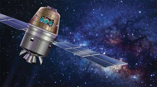
Mission Possible!
India gears up for Gaganyaan,
India’s manned mission to space.
With the approval of the Government funding Indian Space Research Organisation (ISRO) targets the manned space mission by December 2021.
Before this, it plans two non-crew flights in December 2020 and July 2021.
The mission will be capable of carrying three Indian astronauts and will orbit the Earth …
January 2019
Cognizant Autonomous Systems for Safety Critical Applications (CASSCA) 2019
28-29 January
Reston, VA USA
www.ion.org
International LiDAR Mapping Forum (ILMF)
28 – 30 January
Denver, United States
www.lidarmap.org
International Technical Meeting (ITM)/
Precise Time and Time Interval Systems and Applications (PTTI) 2019
28-31 January
Reston, VA USA
www.ion.org
March 2019
2019 URSI Asia Pacific Radio Science Conference
9 – 15 March New Delhi, India
www.aprasc2019.com
Munich Satellite Navigation Summit
25 – 27 …

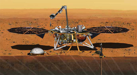
InSight lander
On 26 November 2018
Humanity achieved another milestone
When InSight lander successfully landed on Mars.
Launched on 5th May 2018
It not only intends to study the deep interiors of the Mars
And evolutionary processes
but also the possible seismic activity there.
However, the mission gets an unexpected breakthrough
When it is said to have recorded the sounds of wind
On 1 December …
January 2019
TUSEXPO 2019
16-18 Jan
Rotterdam, the Netherlands
https://tusexpo.com
GeoInsurance Europe 2019
22-23 January London, UK
https://geo-ins-eu.coriniumintelligence.com
Cognizant Autonomous Systems for Safety Critical Applications (CASSCA) 2019
28-29 January
Reston, VA USA
www.ion.org
International LiDAR Mapping Forum (ILMF)
28 – 30 January
Denver, United States
www.lidarmap.org
International Technical Meeting (ITM)/
Precise Time and Time Interval Systems and Applications (PTTI) 2019
28-31 January
Reston, VA USA
www.ion.org
March 2019
2019 URSI Asia Pacific Radio Science Conference
9 – 15 …
LabSat 3 Wideband is an RF signal record and replay system with three independently tuneable wideband channels…


 (5.00 out of 5)