Articles in the GNSS Category

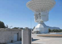
For interplanetary missions, the determination of S/C state vector (position and velocity) is required both for navigation purposes and science operations. The main error sources affecting S/C tracking data are the solar corona and the interplanetary plasma, which could be removed by using the multifrequency link technique between the probe and the ground station [1]. Once solar plasma noise has been removed…

GPS has revolutionised positioning, navigation and timing (PNT) over the last twenty-fi ve years. During this period, we have come to rely on GPS to an unprecedented extent and GPS has gone from being an interesting research and development topic, to a professional niche market maker, to becoming the fourth utility and now to today’s mass market phenomenon…

GPS/INS integrated navigation system has been a candidate of integrity monitoring system since an inertial sensor could improve performance of the fault detection and exclusion (FDE) functions. Japan Aerospace Exploration Agency (JAXA) has developed several GPS/ INS systems called GAIA (GPS Aided Inertial navigation Avionics) for over ten years and succeeded in automatic landing of unmanned experimental…

The GNSS Research and Application Centre of Excellence (GRACE), is a cross disciplinary centre providing cutting edge research, high calibre teaching, and business support services to the GNSS community. In October 2009 GRACE will move into its own state-of-the-art purpose built centre. A ground breaking ceremony took place on the 11th of November 2008, and construction of the centre is underway at the University of Nottingham Innovation Park (UNIP) on the Jubilee campus of the University of Nottingham.
It will be the only facility in UK dedicated to the development of downstream applications and services using GNSS. The European Union has estimated the market for downstream applications and services to be worth in excess of £230 billion by the year 2025. Supporting the University of Nottingham in this venture which will have an investment of £9.2m is the East Midlands Development Agency (EMDA), one of the nine regional development agencies in England. EMDA was established in 1999 with the primary goal to increase the economic growth of the East Midlands region.

Oil was first commercially exploited in the North Sea in the 1960’s. Production is underpinned by regular and reliable helicopter operations enabling the movement of staff and equipment to and from the shore. However, the North Sea environment is challenging for rotorcraft operations from many perspectives, not least its remoteness from the shore, the exacting weather conditions and the changeable nature of rigs…

GNSS (Global Navigation Satellite Systems) is a common acronym encompassing all existing and planned satellite-based navigation systems. So far, the US-built GPS dominates the scene completely, but the Russian GLONASS is approaching around-the-clock global operational status, and other systems are being developed (the European Galileo, the Chinese Compass/Beidou and the Indian IRNSS). There are also augmentation…

Current global navigation satellite systems (GNSSs) [1] are based on signals lying within the L-band of the radio-navigation satellite service (RNSS) spectrum. Since the need for more systems and signals is emerging, new alternative frequency resources are needed. In particular, the C-band frequency portion is envisioned as an option for future GNSSs…

The Wenchuan Earthquake occurred in Sichuan Province, China on the 12th May 2008 with M 8.0 in Richter Scale and 10km depth which resulted in more than 90,000 dead and missing. It is reported that the total loss is more than 170 Billion US Dollars…

Demand for Satellite Navigation technology and applications keeps on increasing in a wide range of economical, social, technological and environmental sectors. This growing interest in the development of Satellite Navigation Systems is demonstrated by the interest of several countries in starting the development of new systems or contributing to existing ones. The major rational behind is…

GESS (GRAIL Environment and Sensor Simulator) is a real-time software prototyped for analysing the GNSS introduction in rail sector. It has been developed by DEIMOS Space in the frame of the GRAIL (GNSS Introduction in the RAIL Sector) contract, lead by Ineco/Tifsa, for the GNSS Supervisory Authority (GSA)…


 (5.00 out of 5)