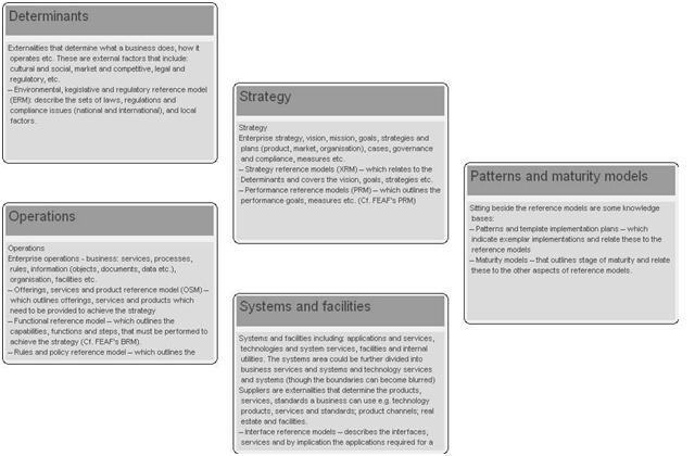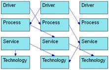
Best practice implementations needs to reflect experience: with cost effective world leading operational national systems; several generations of change i.e. experience with different models of private sector and public sector collaboration; in creating and extending systems of policy, regulation and governance; of the affects of different governance regimes, cultures and from international programmes. They therefore need to cover:

Around the transit area between the indoor and outdoor environments of buildings, it is anticipated that the number of available measurements may not be sufficient for localization and the undesirable non-line-of-sight (NLOS) and multipath errors would severely deteriorate the localization accuracy. To estimate user location reliably where measurements from global positioning system (GPS) receivers are corrupted or not available, network-based methods have been actively investigated.

Nowadays, a growing number of GNSS users demand highly-accurate positioning with minimal latency. PPP is a new positioning technique providing centimeter-level error. Precise Point Positioning (PPP) processes measurements from a single user receiver, using detailed physical models and corrections, and precise GNSS orbit and clock products computed beforehand.
March 2011
International Hydrographic Seminar
3 – 4 March
Delhi, India
www.hydrobharatnic.in/HYDROIND_2011.htm
GEOFORM-2011
15-18 March
Moscow, EcoCentre Sokolniki
www.geoexpo.ru/defaulteng.stm

In a modern mobile mapping system, the navigation component usually consists of a GPS receiver and an inertial navigation system (INS), which can provide accurate geo-referencing to the imaging sensors [1][2]. To achieve centimetre-level positioning accuracy, RTK-GPS is a natural choice. However, RTK-GPS in urban areas suffers from frequent outages due to blockages of either the GPS signals or the reference station radio links. In addition, multipath from buildings, trees and heavy vehicles could degrade the accuracy of the GPS when the vehicle is near them.
NRSC inducts state of the art Airborne Large Format Digital Camera into service
National Remote Sensing Centre, Hyderabad, India has inducted state of the art Airborne Large Format Digital Camera (LFDC) into the country and successfully carried out the first operational task during December, 2010 over 10 towns in Chhattisgarh state for the Department of Land Records, Government of Chhattisgarh. NRSC utilized it Super King Air B -200 aircraft fitted with Computer Controlled Navigation System (CCNS), Gyro stabilized mount and Kinematic GPS system (KGPS) for the survey.
Consumers share uneasy relationship with LBS
Location-based advertisements prompt nearly half of customers to take action, says a new study from Microsoft. The Microsoft-commissioned research in the UK, Germany, Japan, the U.S. and Canada, and found that 18% of consumers (22% in the U.S.) have seen an advertisement based on their location. Of those, 46% have taken action, including redeeming the coupon offered or visiting the store. Nine in 10 users think location-based ads are useful.


 (5.00 out of 5)