FlytGCS Enterprise for remote drone fleet operations
FlytGCS, is a cloud-based remote operations solution for drone operators and service providers. As the commercial drone market matures, professional drone operations are maturing to enterprise ones – with corporations across the world building in-house drone fleets and programs, runnings PoCs and pilots for multiple use-cases, and investing in …
NASA and METI release ASTER Digital Elevation Model Version 3
The US National Aeronautics and Space Administration (NASA) and the Ministry of Economy, Trade, and Industry (METI) of Japan jointly released Version 3 of the Advanced Spaceborne Thermal Emission and Reflection Radiometer (ASTER) Global Digital Elevation Model (GDEM), recently. The ASTER GDEM is available at no …
US Space Command established
In a move to enhance the United States’ space superiority capabilities, President Donald J. Trump, Vice President Mike R. Pence, Secretary of Defense Dr. Mark T. Esper and Air Force Gen. John W. Raymond formally established the United States Space Command during a ceremony held Aug. 30 at the White House.
At the …
UN-GGIM recommends establishing a Global Geodetic Centre of Excellence
The UN-GGIM Subcommittee on Geodesy has recommended establishing a Global Geodetic Centre of Excellence to strengthen the capacity to implement the UN General Assembly resolution. The subcommittee is presenting the second iteration of the position paper defining appropriate governance arrangements.
The Global Geodetic Reference Frame (GGRF) is in …

Volume XV, Issue 8, August 2019
Zip
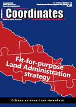
Development of fit-for-purpose land administration country strategy
Uma Shankar Panday, Janak Raj Joshi, Raja Ram Chhatkuli, Stig Enemark, Danilo Antonio and Jagat Deuja
A comparison of fuzzy logic based and artificial neural network approach to urban planning issues
Akpee Dinebari, Kingdom Naabula, Owanate Kpu npamo B and Bonny Nee bee
Citizen science tree inventory
Nurul …

An outage
That lasted a weeklong (11th July’19 onwards)
Again re-emphasizes the GNSS vulnerabilities.
As stakes are high, so are the worries.
There will be plausible explanations
To such technical incidents
Yet they do not lessen the likely consequences.
Voices making the case for complementarity among GNSS systems
And lobby for back-up system
Gain further credence.
Bal Krishna, Editor
bal@mycoordinates.org
Tweet
August 2019
Esri India User Conference
User Conference, Hyderabad August 20, The Park User Conference, Kolkata August 22, Hyatt Regency Kolkata User Conference, Delhi August 28 – 29, The Leela Ambience Gurugram Hotel
https://www.esri.in
Hidden Geographies: Slovenia 2019
28-31 August
http://hiddengeographies.geografija.si
September 2019
GI4DM
16 – 20 September
Miami, Florida, USA
www.ion.org
Interdrone
3 – 6 September
Las Vegas, USA
www.interdrone.com
57th Photogrammetric Week
9 – 13 September 2019
Stuttgart, Germany
https://phowo.ifp.uni-stuttgart.de
Intergeo 2019
17 – …


 (5.00 out of 5)