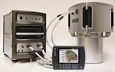
Could you highlight the strengths of Vexcel Imaging large and medium format camera’s for our readers.
The strength of Vexcel is outstanding market knowledge, unparalleled technical experience and the attitude for innovation, all combined to maximize the customer benefi t of our products. Vexcel entered the market of digital large format aerial cameras in 2004, about three years later than the competition with a new concept, the UltraCam. Since then we have increased our market share constantly and became the market leader quickly – we have sold more than 125 UltraCams and additionally quite some camera upgrades. Obviously the market has decided for frame cameras and has made the UltraCam the most successful large format camera series.
The UltraCamXp combines an excellent parallax free image, a pansharpen ratio of 1:3 with the industry leading collection capacity of 17,310 pixels across the strip. Due to the fast frame rate and the innovative storage system, large scale mapping can be performed at reasonable fl ight speed without any mission duration restrictions due to the camera system. The UltraCamXp reduces the number of flight lines, saves time, and lowers costs, without sacrifi cing any image quality.
In 2009, we transformed this winning concept into the medium format market with the UltraCamLp; another excellent example of our strive to maximize customer benefi t. This camera comes in a medium format pricing package and delivers the same image quality such as geometric accuracy, radiometric dynamic and matching, and stereo capability as the UltraCamXp. This means, smaller companies which still operate analogue cameras have the possibility to go digital. The UltraCamLp utilizes a 92 Megapixel PAN channel for mapping and in addition RGB and NIR with a pansharpen ration of 1:2, all motion blur free due to FMC by TDI. This whole concept is new and unique in the medium format market.
This autumn, we will announce the UltraCamXp w/a (wide angle), which is offered in parallel to the UltraCamXp. With a new wide angle lens system, it delivers the same GSD at lower flight altitudes providing small-scale mapping capabilities for customers with lower-fl ying airplanes.
How is UltraMap different from other Photogrammetric software?
UltraMap is another excellent example of how Vexcel customers benefi t from the acquisition of Vexcel by Microsoft in 2006. UltraMap introduces a completely new philosophy of image handling that results in a very high level of automatization and a market leading image processing effi ciency. The graphical user interface has been designed by following the huge Microsoft internal experience. The distributed processing utilizes the latest Microsoft technology and the integrated workfl ow is based on more than a decade of experience in photogrammetry.
All this was combined for only one reason: to set a new standard in image processing and to enable our camera customer to deliver the highest possible quality in the shortest possible time. A new stitching methodology which we will implement with UltraMap version 2.0 improves the “one micron sigma naught accuracy” by factor of fi ve. UltraMap is fully workfl ow oriented and designed to process, handle and display projects with several thousand images. It also fully and seamlessly supports projects which have been flown with different UltraCam cameras.
“Vexcel Imaging Aerial Mapping products give amazing results for less.” How do you manage this balance between quality and price?
Thank you very much for this very important question. The leading design goal at Vexcel is quality. We are proud that we understand very well how to develop industry leading high-end products and still be able to offer them for a reasonable market price. We achieve this by a balanced combination of proprietary high-end technology with standard components and the unique approach to how we look into technology and innovation. We consider Vexcel as an innovation leader in the industry and constantly undertake signifi cant investments into proprietary key components such as CCD technology, electronics, shutter and lens development. We also constantly monitor technology trends. Once a new development or a new technology has reached a stage where the customer would benefi t from it, we integrate it into our product. By that, a Vexcel customer always benefi ts from the best technology for his business. To protect the investment of existing customers, we always offer an upgrade path which is highly appreciated and frequently used by our wide customer base.
Could you highlight some application areas where Vexcel Aerial Mapping products have an advantage over other geospatial products?
Vexcel products are serious tools for serious mapping. The combination of excellent image quality with unparalleled efficiency makes an UltraCam the tool for all mapping projects. In each market segment, Vexcel sets the standard – in the large format market: the UltraCamXp sets the standard with 17,310 pixels across and the pan-sharpen ration of 1:3 is best in class for the frame cameras in this segment making the UltraCam also the tool for classification projects. In the medium format market: 92 Megapixel PAN plus RGB plus NIR, integrated in one UltraCamLp camera head are unparalleled in this market segment, too.
Generally, the current Vexcel cameras are designed for large scale applications, driving the trend of the industry towards higher resolution. With the UltraCamXp w/a, we now announce an additional camera which adds small scale mapping capability to those customers with low-altitude planes.
With the proliferation of geospatial products from a variety of sources, how do you see the Aerial Mapping products making an impact in the coming years?
Aerial mapping products have played a dominant role since years and the importance will continue to grow. Aerial images support the trend towards higher resolution and can be collected quickly, flexible and with a high effi ciency, compared to the resolution and content one gets. Due to camera capabilities and new software systems such as UltraMap, projects with ten thousands of images will become a commodity. Data processing of large projects will take some days only. All this will leverage the usage of aerial images over other geospatial products.
You have seen this industry grow in the last decade do you think the technological advances in the products have fully been utilized by the user community?
My answer depends on which part of the value chain one focuses on. Digital cameras and the related processing software provide a lot of benefi t for the user and the transition from analogue to digital continues. We have customers fl ying 95% to 100% of their business in the digital world. I am sure that all UltraCam users have fully utilized the technology advances for their business. However, I strongly believe that further down the value chain the users of the images have only explored a fraction of the applications which could benefi t from aerial imagery. There is still a lot of potential out and yet undiscovered for the usage of aerial images.
Aerial Mapping products have been used extensively in some parts of the world, but not so in others – which upcoming markets do you think have a good potential in the coming year?
We believe in a general growth of photogrammetry in all markets but with different speed and potential. In Europe digital photogrammetry is already established very well. We see signifi cant growth potential in the USA, especially for the UltraCamLp, allowing the smaller companies to go digital. The same potential we see in Latin America. Asia is still quite underdeveloped and we are currently investing into sales and support structures there. We announced our new regional sales representative, Imagemaps based in Singapore, just recently.
What is your opinion about global sensor market, LIDAR and photogrammetry? What according to you are key points to enhance its growth?
We see the global sensor market growing in the coming years and photogrammetry will continue to gain market share constantly. When Lidar became available, some said that photogrammetry will be replaced by Lidar. This did not happen; the opposite happened. What we currently see is the re-launch of photogrammetry, the digital multi-ray photogrammetry. Huge mapping projects such as Microsoft Bing maps (former Virtual Earth) have chosen digital multiray photogrammetry as the underlying production methodology because of the outstanding ratio between collection efficiency, achievable accuracy and processing automatization, and capability of DSM and DTM generation as well as classifi cation results. To drive this re-launch of photogrammetry ahead, we continue to invest into new camera hardware but especially we see a huge potential in the further development of the processing software. Looking into the research we are currently undertaking at Microsoft Vexcel, I can promise that we have just scratched the surface of what photogrammetry will do for all of us in the future.
|


 (No Ratings Yet)


