Articles in the Surveying Category


A new non-parametric approach, WILDetect, has been built using an ensemble of supervised Machine Learning (ML) and Reinforcement Learning (RL) techniques. We present here the first part of the paper. The concluding part will be published in next month
Kaya Kuru
Corresponding author School of Engineering, University of Central Lancashire, Fylde Rd, Preston, Lancashire, PR12HE, UK
Stuart Clough
APEM …

This paper sheds light on the key obstacles that prevent the widespread recognition and appreciation of surveying and mapping in Nigeria
PEPPLE, Godwill Tamunobiekiri
Department of Surveying and Geomatics Faculty of Environmental Sciences Rivers State University Port Harcourt, Nigeria
ALAPA, Deborah Gold
DG ALAPA’s Consult Ltd Karu, FCT Abuja.
IRUMHE, Henry Omoloize
Department of Surveying …

This article has identified and grouped 6 challenges the Surveying profession is grappled with in order to ensure its future and survival
Godwill Tamunobiekiri Pepple
Department of Surveying and Geomatics, Faculty of Environmental Sciences Rivers State University Port Harcourt, Nigeria
Emilia Biobele West
Department of Surveying and Geomatics, Faculty of Environmental Sciences Rivers …
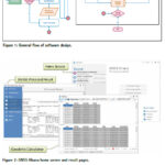
“GNSS Ghana” Software (GGS), a GNSS standalone Windows-based application with a modern user-friendly interface was developed for geodetic applications
Gameti Charles
Department of Geomatic Engineering, Kwame Nkrumah University of Science and Technology (KNUST), Kumasi, Ghana
Acheampong Akwasi Afrifa
Department of Geomatic Engineering, Kwame Nkrumah University of Science and Technology (KNUST), Kumasi, Ghana
John Ayer
Department of Geomatic Engineering, Kwame Nkrumah University …

In Australia, all land dimensions are only horizontal ground distances and all surveying and mapping coordinates are only on 60 UTM projection. Comparatively simple and unconfused, this Australian coordination practice has proven itself over the last 50 years and can claim to be the best survey coordination and mapping system in the world
John Read
FIS NSW, Emeritus Surveyor …

This land surveyor apps was implemented to enable effective and efficient data collection on party, boundary and document sources referring to ISO 19152 standard known as Land Administration Domain Model
Trias Aditya
Head of Department of Geodetic Engineering, Faculty of Engineering, Universitas Gadjah Mada (UGM), Indonesia
Introduction
A conventional approach in land registration applies a mandatory field boundary demarcation …

This paper outlines how a state-wide Digital Elevation Model (DEM) has been used to deliver better approximate Australian Height Datum (AHD) heights, yielding a homogeneous dataset of known provenance and verifiable quality across New South Wales (NSW), Australia.
Jonathon Smith
Senior Technical Surveyor in the Survey Operations Regional team at DCS Spatial Services, NSW Department of Customer …

Addressing national datum modernisation, this paper presents a new approach to include static Network Real-Time Kinematic (NRTK) observations and their uncertainties in the survey control network of New South Wales (NSW), Australia.
Tom Bernstein
Senior Technical Surveyor in the Metropolitan Operations & Preservation of Survey Infrastructure team at DCS Spatial Services, NSW Department of Customer Service, in …

This paper evaluated a real-time KSACORS-based NRTK GNSS-INS integrated solution and a post-processed KSACORS-based NPPK GNSS-INS integrated solution
Mohammed El-Diasty
PhD, P. Eng. Civil and Architectural Engineering Department, College of Engineering, Sultan Qaboos University, Muscat, Oman
Abstract
Multibeam echosounding technique is used to provide sea-floor mapping with relatively high-quality level and requires an accurate positioning and attitude system. Integration …

Mount Everest is often considered “a symbol of something impossible”. For mountaineers standing atop Everest, near the Nepal-China border on the huge ice block that caps its peak, it is a life-time dream…


 (5.00 out of 5)