
Cepton announced that it is working with LidarSwiss Solutions GmbH to deploy its lidar technology in a drone-based mapping and analytics solution for infrastructure management and engineering design applications.
LidarSwiss is a Switzerland-based provider of high-performance unmanned aerial vehicle (UAV) based lidar solutions. Utilizing Cepton’s industry-leading Sora lidar sensor, its Nano P60 system provides high-fidelity mapping …
Planet Labs PBC, a leading provider of daily data and insights about Earth, has announced NASA has exercised an option to extend its contract with Planet under the Commercial SmallSat Data Acquisition (CSDA) Program through September 2023. Planet has been providing data to NASA scientists and federally funded researchers under this program since 2018 and …
Volume XVIII, Issue 10, October 2022
Cadastre forensics, para surveyor and mobile app for land registration
Trias Aditya
…
November 2022
Trimble Dimensions 2022
7-9 November 2022 Las Vegas, USA
…

Kiyokazu Minami and Takeyasu Sakai of Japan Institute of Navigation discuss the scenario of navigation technologies in Japan in an interview with Coordinates magazine
…
Aerial Lidar mapping with TOPODRONE and Velodyne Lidar
Aerial Lidar mapping with TOPODRONE and Velodyne Lidar TOPODRONE has announced the synchronization of LiDAR PRIME scanner and aOrion Heli-E UAV enabled by Velodyne’s Alpha Prime sensor. This new mapping solution fills the gap between heavyweight and expensive manned aerial …

Pentagon warns of GPS interference from Ligado broadband network
As required by Congress in section 1663 of the 2021 National Defense Authorization Act, the National Academies of Science, Engineering and Medicine (NASEM) committee recently released its study on Ligado’s planned deployment of terrestrial services and its potential to …
Pampady, Kerala completes mapping of water bodies
Pampady in Kottayam has become the first block panchayat in the state of Kerala, India to complete digital mapping of all its water courses.
An official statement said 174.3 km-long water courses including streams and canals across eight grama panchayats within the block panchayat had been mapped with active public …

The principal objective of this research is to investigate the applicability of UAV photogrammetry integrated with automatic feature extraction for cadastral mapping. We present first part of the paper in this issue.The concluding part will be published in the next issue.
Oluibukun Gbenga Ajayi
Department of Land and Spatial Sciences, Namibia University of Science and Technology, Namibia
Emmanuel …

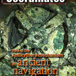
The paper delineates an important potential role for the Mechanism in a navigational process practiced by mariners in the
18th and 19th centuries
James E. (Jim) Wyse
Chief Scientific and Technology Officer, Maridia Research Associates Professor (Ret’d), Memorial University, Canada
Abstract
Since its recovery in 1901 from the seabed near the small Greek island of Antikythera northwest of Crete, a …


 (5.00 out of 5)