
Leica GPro version 3.2 launched
With the new version 3.2 for its Leica GPro download and ground processing software, Leica Geosystems is now offering improvements and new capabilities to its Airborne Sensor customers, such as increased speed and simplified handling. In this new version 3.2, Leica GPro offers a new project information file structure, which enhances usability and productivity. Increased speed for pixel-wise orthorectification is provided. Plus, Leica GPro now supports the newly launched ADS40 2nd Generation sensor heads SH51 and SH52.
www.leica-geosystems.com

The GPS is a ubiquitous tool on the planet today. Its ability to pinpoint a person’s position on the globe, and store information about that location has been one of the most significant contributions to society in the latter Twentieth Century. Currently, the systematic collection of geospatial attribute data is limited to very expensive GPS receivers and specially trained personnel. The general procedure for collecting geospatial attributes with the consumer-grade GPS has required the use of “add-ons”, such as hand-held computers, laptops and palm pilots. These add-ons are frequently outside of the financial and technical reach of many communities, organizations and under funded agencies. The protocols and procedures presented here are designed to modify and merge existing methods and technologies to overcome these financial and technical barriers.

Spatial data is the fuel for 3D Applications, but all too often the fuel supplied is inappropriate. The software applied and expertise required when modelling a flood event or predicting a cityscape’s lineof-site is exactly the same using highly precise data as it is for generalised data. The difference is in how well that analysis relates to the real world … i.e. whether the analysis is correct or not. Conversely, supplying highly accurate or dense data to a generalised analysis can cost both time and money which is not reflected in the final product. Hence the word of this paper is: appropriate. Apply the most appropriate data to your application. There is nothing wrong with “approximate” or “inexpensive” 3D data, as long as it is appropriate for the level of analysis being performed.

Indian Space Research Organisation (ISRO) has taken up a project called Indian Regional Navigation Satellite System (IRNSS) for the establishment of an independent regional navigational infrastructure. The system main objective is to provide high positional accuracy (comparable to the existing constellations) real time position, velocity and time for various users in the region. IRNSS services will be available on a 24x7x365 basis irrespective of the availability of other constellations over Indian airspace. The system leverages the technological competence of ISRO in satellite, ground and other critical technologies
Ordnance Survey vision helps shape a VISTA for underground assets
VISTA (Visualising integrated information on buried assets to reduce street works) is a collaboration of 21 organisations developing an integrated infrastructure to enable data sharing for all buried assets across Great Britain. Ordnance Survey’s intelligent large-scale data OS MasterMap Topography Layer is the reference base underpinning preliminary trials by researchers at Leeds and Nottingham Universities to integrate disparate records of buried pipes, cables, ducts and wires. VISTA will combine this information with in-situ survey observations using real-time centimetre-level services provided by OS Net, Ordnance Survey’s GPScorrection network, and by Leica Geosystems’ SmartNet, which is enabled by OS Net. OS Net is a network of more than 90 GPS base stations that improves the standard accuracy of raw GPS readings to augment any application that requires GPS positioning. www.ordnancesurvey.co.uk
Leica AT504 Geodetic Choke Ring Antenna now supports GNSS
With the introduction of the Leica AT504 GG, Leica Geosystems is announcing a brand new version of its successful AT504 choke ring antenna for permanent reference stations and networks. This new antenna tracks GNSS observations, supplying high quality GPS and GLONASS data when used in conjunction with Leica GPS1200 GNSS receivers. The design of the AT504GG choke ring antenna effectively suppresses multipath effects and has a very stable phase center making it ideally suited for geodetic applications using GNSS observations.
Leica Geosystems also introduces the new V2.2.0 for Leica GPS Spider software for GPS reference stations and networks. With this new update of GPS Spider, Leica Geosystems continues its policy of continued product development and improvement of its GPS Reference Station solutions. www.leica-geosystems.com

In the last several years we have seen an explosion of consumer GPS products. Telematics systems, LBS applications on cell phones, GPS-enabled PDAs, and more novel GPS products such as pet finders have flooded the marketplace, with new products and applications announced almost daily. Likewise, public awareness of the potential utility of GPS has increased. Microsoft’s and Google’s entrance into the GPS and mapping market have helped accelerate consumer understanding and adoption of location technology. This is also causing a major demand among users of LBS technology to “show what is around me.” In a word, GPS is a general term in the marketplace to which consumers are accustomed in how they understand and explain all location-enabled products and applications. What’s interesting is that GPS is not even the positioning-enabling (or location-enabling) technology inside many of these new locationaware applications that are getting a lot of traction these days. Moreover, Google and the other online mapping consumer websites are a disruptive technology for GPS because they don’t require the use of GPS – users can either self provision by entering a street intersection or applications like Google Local and Microsoft Local Live use WiFi for location sensing to the nearest access point.

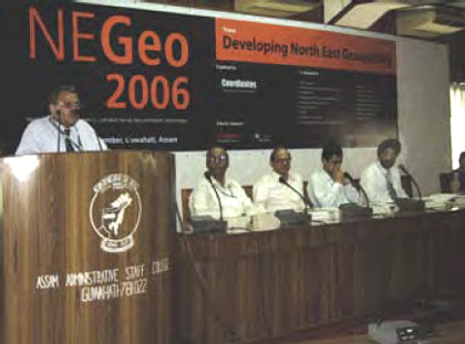
To carry out the infrastructural development in any area, topographical maps (accurate, reliable and updated) of that area are of vital important. Topographic maps are also important aids for administrative and strategic planning, disaster mitigation, socioeconomic development and other related activities. In order to prepare topographic map, it is prerequisite to have grid coordinates as well as elevations of control points.

Says Flemming Lindholm, Regional Sales Manager-Europe, Asia …


 (5.00 out of 5)