Over 650 years of experience in spatial information management, land administration and spatial enablement were percolated into 22 presentations offering a raft of initiatives and insights across the world corresponding with the theme of the forum, “Beyond Spatial Enablement’- Land Administration to support Spatially Enabled Government”

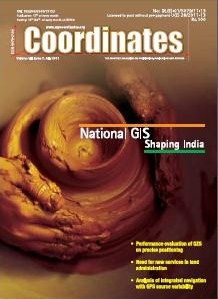
Performance evaluation of the effect of QZS (Quasi-zenith Satellite) on precise positioning: Nobuaki Kubo, Tomoko Shirair, Tomoji Takasu, Akio Yasuda, Satoshi Kogure;
Need for new services in land administration: András Osskó;
Analysis of integrated navigation with GPS source variability:Mahmoud Efatmaneshnik, Yong Li, Allison Kealy, Andrew G Dempster

Accurate geo-referencing and DSM generation with HRSI
Armin Gruen
Navigation in India: smooth sail or a bumpy ride
Amit Prasad, Shivalik Prasad, Ashutosh Pande, Raghvendra Krishnamurthy Shashank N Dhaneshwar, Alok Shankar
Yes, we can!
Chandrayaan
Is surveying a dying profession?
Francis W Derby
Surveying is not a dying profession
AW Mir
Understanding land administration systems
Ian P Williamson, Stig Enemark, Jude Wallace, Abbas Rajabifard

As part of the 17th United Nations Regional Cartographic Conference for Asia and the Pacific (UNRCC-AP) held in Thailand in September 2006, Working Group 3 of the Permanent Committee for GIS Infrastructure for Asia and the Pacifi c (PCGIAP) organised a one-day international workshop (21st September 2006) on the‘Integration of Built and Natural Environmental Datasets within National SDI Initiatives’. The workshop was conducted with the support of the Centre for Spatial Data Infrastructures and Land Administration, the University of Melbourne.

Height of Mount Everest MUNEENDRA KUMAR
An alternative low cost MEMS IMU/GPS integration scheme incorporating artificial intelligence KAI-WEI CHIANG AND NASER EL-SHEIMY
Positional accuracy and integration of geographic data CARSTEN RÖNSDORF
The role of cadastral data modelling in e-Land administration KALANTARI M, RAJABIFARD A, WALLACE J AND WILLIAMSON
Malaysia precise geoid (MyGEOID) AHMAD FAUZI NORDIN, SAMAD HJ ABU, CHANG LENG HUA AND SOEB NORDIN

While digital techniques were introduced to map production in the 1970’s, the driver for utilising digital tools to manage this wide range of activities was the land administration functions of the six states and two territories. Developed in concert by the legal and surveying professions, these state and territory based land administrations functions led to digital land valuation systems as early as 1968 in South Australia. Building upon such initiatives; government guaranteed computerised land registration and automated valuation systems have been built.


 (5.00 out of 5)